La Granja (Chili)
Cet article est une ébauche concernant une localité chilienne.
Vous pouvez partager vos connaissances en l’améliorant (comment ?) selon les recommandations des projets correspondants.
| La Granja commune du Chili | |
 Logement social La Torta | |
| Administration | |
|---|---|
| Pays | |
| Province | Santiago |
| Région | Santiago |
| Démographie | |
| Gentilé | Granjino, -na |
| Population | 120 328 hab. (2012 |
| Densité | 12 033 hab./km2 |
| Géographie | |
| Coordonnées | 33° 32′ 00″ sud, 70° 37′ 30″ ouest |
| Altitude | 606 m |
| Superficie | 1 000 ha = 10 km2 |
| Localisation | |
| modifier |
|

La Granja est une commune du Chili faisant partie des quartiers sud de la capitale Santiago elle-même située dans la zone centrale du Chili. En 2012, sa population s'élevait à 120 328 habitants. La superficie de la commune est de 10 km² (densité de 12 033 hab./km²)[1]. La commune est créée en 1892 : le premier quartier a été édifié vers les 25-27 avenue Santa Rosa. Les franciscains ont joué un grand rôle dans l'histoire de la ville et ils ont édifié une première chapelle en 1825 qui fut démolie en 1901 et remplacée en 1908 par l'église actuelle située sur le territoire de la commune de San Ramon[2].
Sur le territoire de la commune se trouve le Parque Brasil, un des plus grands espaces verts de la capitale (51 hectares) dans lequel se trouve le Museo Interactivo Mirador un musée consacré aux sciences et à la culture avec une approche interactive. La commune est desservie par le métro de Santiago. Sur son territoire se trouvent deux stations de la ligne 4A : La Granja située rue Coronel et Santa Rosa implantée Avenue Santa Rosa. La commune est également desservie par le réseau de bus Transantiago. Ceux-ci disposent de deux couloirs réservées sur les avenues Santa Rosas et Las Industrias. Deux autoroutes urbaines traversent la commune : le périphérique sud Vespucio d'ouest en est et Acceso Sur, un axe nord sud. La Granja dispose de 6,5 kilomètres de pistes cyclables.

-
 Museo Interactivo Mirador.
 -
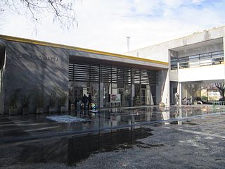 Centre culturel Espacio Matta.


Notes et références
[modifier | modifier le code]- (en) David Bravo, Osvaldo Larrañaga, Isabel Millán, Magda Ruiz, Felipe Zamorano, « Anexos al Informe Final Comisión Externa Revisora del CENSO 2012 », Instituto Nacional de Estadísticas,
- (es) Subsecretaría de Desarrollo Regional y Administrativo, « Gobierno Regional Metropolitano de Santiago › Provincia de Santiago > La Granja », sur Gobierno de Chile (consulté le )
Voir aussi
[modifier | modifier le code]Articles connexes
[modifier | modifier le code]Liens externes
[modifier | modifier le code]
Text is available under the CC BY-SA 4.0 license; additional terms may apply.
Images, videos and audio are available under their respective licenses.
