Fichier:Upper West Ghana districts.png
Taille de cet aperçu : 776 × 600 pixels. Autres résolutions : 311 × 240 pixels | 621 × 480 pixels | 994 × 768 pixels | 1 056 × 816 pixels.
Fichier d’origine (1 056 × 816 pixels, taille du fichier : 35 kio, type MIME : image/png)
Ce fichier et sa description proviennent de Wikimedia Commons.
Description
| Description |
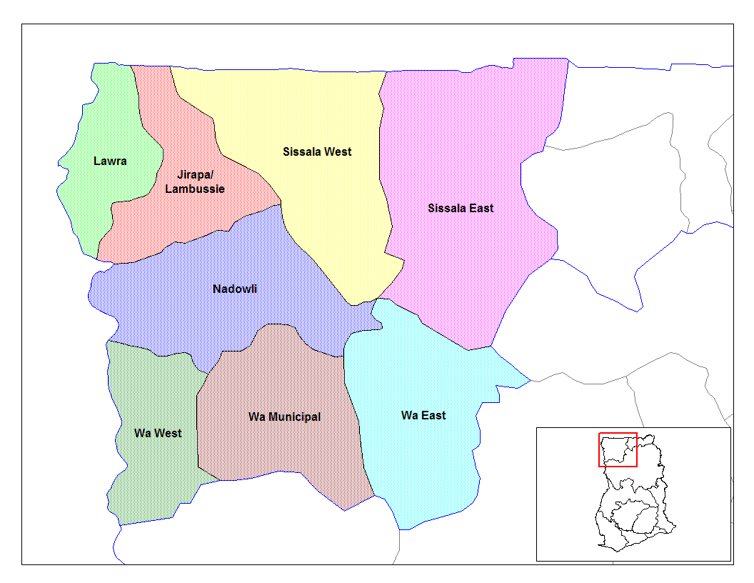
English: Map of the districts of the Upper East region of Ghana. Created by Rarelibra for public domain use. Created using MapInfo Professional v7.5 and various mapping resources. |
| Date | 28 juin 2006 (date de téléversement originale) |
| Source | Travail personnel |
| Auteur | User:Rarelibra |
Conditions d’utilisation
| Moi, propriétaire des droits d’auteur sur cette œuvre, la place dans le domaine public. Ceci s'applique dans le monde entier. Dans certains pays, ceci peut ne pas être possible ; dans ce cas : J’accorde à toute personne le droit d’utiliser cette œuvre dans n’importe quel but, sans aucune condition, sauf celles requises par la loi. |
Journal des téléversements d’origine
- (del) (cur) 07:52, 5 March 2006 . . Rarelibra (Talk | contribs) . . 1056x816 (33,321 bytes) (Map of the districts of the Upper East region of Ghana. Created by Rarelibra for public domain use. Created using MapInfo Professional v7.5 and various mapping resources.)
Historique du fichier
Cliquer sur une date et heure pour voir le fichier tel qu'il était à ce moment-là.
| Date et heure | Vignette | Dimensions | Utilisateur | Commentaire | |
|---|---|---|---|---|---|
| actuel | 28 juin 2006 à 21:06 | | 1 056 × 816 (35 kio) | Ahanta | from en:districts of ghana Map of the districts of the Upper East region of Ghana. Created by Rarelibra for public domain use. Created using MapInfo Professional v7.5 and various mapping resources. [edit] I, the creator of this work, hereby release it in |
Utilisation du fichier
Les 9 pages suivantes utilisent ce fichier :
Usage global du fichier
Les autres wikis suivants utilisent ce fichier :
- Utilisation sur ca.wikipedia.org
- Utilisation sur dag.wikipedia.org
- Utilisation sur de.wikipedia.org
- Utilisation sur en.wikipedia.org
- Utilisation sur es.wikipedia.org
- Utilisation sur fa.wikipedia.org
- Utilisation sur gpe.wikipedia.org
- Utilisation sur ha.wikipedia.org
- Utilisation sur ig.wikipedia.org
- Utilisation sur it.wikipedia.org
- Utilisation sur ja.wikipedia.org
- Utilisation sur ko.wikipedia.org
- Utilisation sur la.wikipedia.org
- Utilisation sur nl.wikipedia.org
- Utilisation sur pl.wikipedia.org
- Utilisation sur pt.wikipedia.org
- Utilisation sur ro.wikipedia.org
- Utilisation sur sw.wikipedia.org
- Utilisation sur tr.wikipedia.org
- Utilisation sur ts.wikipedia.org
- Utilisation sur tw.wikipedia.org
- Utilisation sur uk.wikipedia.org
- Utilisation sur ur.wikipedia.org
- Utilisation sur www.wikidata.org
- Utilisation sur yo.wikipedia.org
Voir davantage sur l’utilisation globale de ce fichier.
Text is available under the CC BY-SA 4.0 license; additional terms may apply.
Images, videos and audio are available under their respective licenses.
Cover photo is available under {{::mainImage.info.license.name || 'Unknown'}} license.
Cover photo is available under {{::mainImage.info.license.name || 'Unknown'}} license.
Credit:
(see original file).
