For faster navigation, this Iframe is preloading the Wikiwand page for Fichier:Plan de Bordeaux et de ses environs, par Hippolyte Matis.jpg.

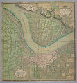
Fichier:Plan de Bordeaux et de ses environs, par Hippolyte Matis.jpg

Fichier d’origine(3 705 × 4 000 pixels, taille du fichier : 4,03 Mio, type MIME : image/jpeg)

Ce fichier et sa description proviennent de Wikimedia Commons.

Description

Description Plan de Bordeaux et de ses environs, par Hippolyte Matis, (1716-1717).
Date entre 1716 et 1717
date QS:P,+1716-00-00T00:00:00Z/8,P1319,+1716-00-00T00:00:00Z/9,P1326,+1717-00-00T00:00:00Z/9
Source http://www.cg78.fr/archives/img/db/seriea/hd/sa00022.jpg (lien expiré Nov. 2011)
Auteur
Hippolyte Matis    wikidata:Q57710227
 
Description cartographe français
Lieu de travail
Autorité
creator QS:P170,Q57710227

Conditions d’utilisation

Public domain

Cette œuvre est également dans le domaine public dans tous les pays pour lesquels le droit d’auteur a une durée de vie de 100 ans ou moins après la mort de l’auteur.


Vous devez aussi inclure un modèle indiquant pourquoi cette œuvre est dans le domaine public aux États-Unis.

Légendes

Ajoutez en une ligne la description de ce que représente ce fichier

Éléments décrits dans ce fichier

dépeint

4 222 457 octet

4 000 pixel

3 705 pixel

image/jpeg

e09520f2bb4ccb272ede03e7472ca3fb76bf0802

Historique du fichier

Cliquer sur une date et heure pour voir le fichier tel qu'il était à ce moment-là.

Date et heureVignetteDimensionsUtilisateurCommentaire
actuel26 avril 2007 à 06:00Vignette pour la version du 26 avril 2007 à 06:003 705 × 4 000 (4,03 Mio)Petrusbarbygere((Information |Description=Plan de Bordeaux et de ses environs, par Hippolyte Matis, (1716-1717). |Source=http://www.cg78.fr/archives/img/db/seriea/hd/sa00022.jpg |Date=1716-1717 |Author=Hippolyte Matis )) Category:Bordeaux [[Category:Old maps of Fra

Utilisation du fichier

Les 4 pages suivantes utilisent ce fichier :

Usage global du fichier

Les autres wikis suivants utilisent ce fichier :

Métadonnées

{{bottomLinkPreText}} {{bottomLinkText}}
Fichier:Plan de Bordeaux et de ses environs, par Hippolyte Matis.jpg
Listen to this article

This browser is not supported by Wikiwand :(
Wikiwand requires a browser with modern capabilities in order to provide you with the best reading experience.
Please download and use one of the following browsers:

This article was just edited, click to reload
This article has been deleted on Wikipedia (Why?)

Back to homepage

Please click Add in the dialog above
Please click Allow in the top-left corner,
then click Install Now in the dialog
Please click Open in the download dialog,
then click Install
Please click the "Downloads" icon in the Safari toolbar, open the first download in the list,
then click Install
{{::$root.activation.text}}

Install Wikiwand

Install on Chrome Install on Firefox
Don't forget to rate us

Tell your friends about Wikiwand!

Gmail Facebook Twitter Link

Enjoying Wikiwand?

Tell your friends and spread the love:
Share on Gmail Share on Facebook Share on Twitter Share on Buffer

Our magic isn't perfect

You can help our automatic cover photo selection by reporting an unsuitable photo.

This photo is visually disturbing This photo is not a good choice

Thank you for helping!


Your input will affect cover photo selection, along with input from other users.

X

Get ready for Wikiwand 2.0 🎉! the new version arrives on September 1st! Don't want to wait?