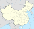
Fichier:China LCC topographic map.svg

Fichier d’origine (Fichier SVG, nominalement de 576 × 496 pixels, taille : 4,79 Mio)
Historique du fichier
Cliquer sur une date et heure pour voir le fichier tel qu'il était à ce moment-là.
| Date et heure | Vignette | Dimensions | Utilisateur | Commentaire | |
|---|---|---|---|---|---|
| actuel | 18 avril 2020 à 13:57 |  | 576 × 496 (4,79 Mio) | Flappiefh | Masks fixed (Hainan and other islands) |
| 18 avril 2020 à 13:49 |  | 576 × 496 (4,82 Mio) | Flappiefh | Graticules completed + masks fixed + coastline fixed | |
| 18 avril 2020 à 11:05 |  | 576 × 496 (4,76 Mio) | Flappiefh | Right projection (equidistant) + hypsometric raster. | |
| 17 avril 2020 à 15:14 |  | 1 920 × 1 534 (4,37 Mio) | Flappiefh | Added chinese provinces | |
| 17 avril 2020 à 13:50 |  | 1 920 × 1 534 (3,65 Mio) | Flappiefh | Uploaded own work with UploadWizard |
Utilisation du fichier
Plus de 100 pages utilisent ce fichier. La liste suivante affiche seulement les 100 premières pages qui utilisent ce fichier. Une liste complète est disponible.
- Aksai Chin
- Ankang
- Baie d'Along
- Banpo
- Bataille de Chengpu
- Canton (Chine)
- Chengdu
- Chifeng
- Chongqing
- Cité interdite
- District de Yizhou
- District de Yongchuan
- District de Yuhang
- Dongtai
- Everest
- Fengcheng (Jiangxi)
- Guilin
- Hailun
- Haimen
- Hainan
- Hengyang
- Jiamusi
- Jiangmen
- Jinzhong
- K2
- Kaifeng
- Kucha
- Lac Namtso
- Lhassa
- Lhotse
- Linhai
- Liste des plus hauts sommets sur Terre
- Makalu
- Massacre de Nankin
- Nankin
- Palais d'Été
- Préfecture autonome tujia et miao d'Enshi
- Pékin
- Qingdao
- Qufu
- Shanghai
- Shangqiu
- Shishapangma
- Suzhou
- Tai Po (district)
- Tianjin
- Tianshui
- Tongzhou (Jiangsu)
- Tourfan
- Trois Gorges
- Weihai
- Wuhan
- Xi'an
- Xian de Barkam
- Xinyang
- Yicheng (Hubei)
- Yichun (Heilongjiang)
- Yichun (Jiangxi)
- Yima (Henan)
- Yinchuan
- Yingcheng
- Yingde
- Yingtan
- Yixing
- Yiyang
- Yizheng
- Yong'an
- Yongcheng
- Yongzhou
- Yuanjiang (Hunan)
- Yuanping
- Yueyang
- Yulin (Shaanxi)
- Yumen
- Yuncheng
- Yunfu
- Yushu (Jilin)
- Yuyao
- Yuzhou
- Zaoyang
- Zengcheng
- Zhalantun
- Zhangjiagang
- Zhangjiakou
- Zhangqiu
- Zhangshu
- Zhangye
- Zhanjiang
- Zhaodong
- Zhaotong
- Zhaoyuan
- Zhoushan
- Zhuanghe
- Zhucheng
- Zhuji
- Zhumadian
- Zhuozhou
- Zhuzhou
- Zixing
- Ziyang
Voir plus de liens vers ce fichier.
Usage global du fichier
Les autres wikis suivants utilisent ce fichier :
- Utilisation sur ckb.wikipedia.org
- Utilisation sur fi.wikibooks.org
- Utilisation sur lt.wikipedia.org
- Utilisation sur lv.wikipedia.org
- Utilisation sur pt.wikipedia.org
Métadonnées
Text is available under the CC BY-SA 4.0 license; additional terms may apply.
Images, videos and audio are available under their respective licenses.

