Fichier:Castle Airport CA 2006 USGS.jpg
Taille de cet aperçu : 587 × 600 pixels. Autres résolutions : 235 × 240 pixels | 633 × 647 pixels.
Fichier d’origine (633 × 647 pixels, taille du fichier : 151 kio, type MIME : image/jpeg)
Ce fichier et sa description proviennent de Wikimedia Commons.
Description
| Description |
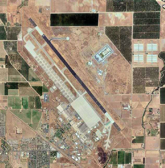
English: USGS digital orthophoto of Castle Airport (formerly Castle Air Force Base) in Merced, California, United States |
| Date | |
| Source |
USGS via GPS Visualizer website |
| Auteur | United States Geological Survey (USGS) |
| Autorisation (Réutilisation de ce fichier) |
Public domain |
| Autres versions |
|

| Position de l'objet | | Voir cet endroit et d’autres images sur : OpenStreetMap |
|---|
Conditions d’utilisation
Cette image est placée dans le domaine public parce qu'elle contient des éléments issus de l'United States Geological Survey, une agence du Département de l'Intérieur des États-Unis. Pour plus d'information, consultez la politique officielle de copyright de l'USGS (en anglais)
|
Historique du fichier
Cliquer sur une date et heure pour voir le fichier tel qu'il était à ce moment-là.
| Date et heure | Vignette | Dimensions | Utilisateur | Commentaire | |
|---|---|---|---|---|---|
| actuel | 26 novembre 2011 à 04:31 | | 633 × 647 (151 kio) | Bwmoll3 | ((Information |Description =((en|1=Castle Airport CA 2006 USGS)) |Source =http://www.gpsvisualizer.com/map_input?special=wikipedia&format=google&bg_map=usgs_aerial&sp_width=50km&form:data=type,name,latitude,longitude%0DW,%22Castle%20Air%20Force |
Utilisation du fichier
La page suivante utilise ce fichier :
Usage global du fichier
Les autres wikis suivants utilisent ce fichier :
- Utilisation sur arz.wikipedia.org
- Utilisation sur ceb.wikipedia.org
- Utilisation sur en.wikipedia.org
- Utilisation sur ro.wikipedia.org
- Utilisation sur ur.wikipedia.org
- Utilisation sur www.wikidata.org
Text is available under the CC BY-SA 4.0 license; additional terms may apply.
Images, videos and audio are available under their respective licenses.
Cover photo is available under {{::mainImage.info.license.name || 'Unknown'}} license.
Cover photo is available under {{::mainImage.info.license.name || 'Unknown'}} license.
Credit:
(see original file).
