Chilpancingo
| Chilpancingo de los Bravo | |
 Héraldique |
|
 Ci-dessus, de gauche à droite : Centre-ville, église Chilpancingo Francisco Assisi, site archéologique de Tehuacalco, The Civic Plaza "First Congress of Anahuac", Chilpancingo Saint Mary Cathedral, Museo de Regional de Guerrero (Musée régional de Guerrero) , la mairie de Chilpancingo et le pouvoir judiciaire. | |
| Administration | |
|---|---|
| Pays | |
| État | Guerrero |
| Maire | Norma Otilia Hernández Martínez (MORENA) |
| Code postal | 39000 |
| Fuseau horaire | UTC-6 Pas d'heure d'été |
| Indicatif | (+52) 747 |
| Démographie | |
| Gentilé | Chilpancinguense |
| Population | 187 251 hab. (2005) |
| Géographie | |
| Coordonnées | 17° 33′ nord, 99° 30′ ouest |
| Altitude | 1 270 m |
| Divers | |
| Fondation | |
| Localisation | |
| Liens | |
| Site web | www.chilpancingo.gob.mx |
| modifier |
|
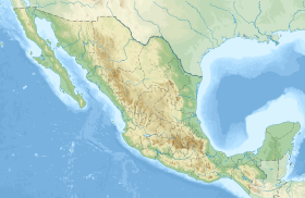
Chilpancingo, ou Ciudad Bravo — nom officiel : Chilpancingo de los Bravo — est une ville du Mexique, capitale de l'État du Guerrero. En 2003, elle avait une population de 152.600 habitants.
Le mot Chilpancingo provient du náhuatl : chilpan qui signifie « là ou il y a des guêpes » et cinco, « pequeño ». La meilleure traduction serait « petit nid de guêpes »[réf. souhaitée].
Elle est traversée par la route fédérale 95, qui relie la ville d'Acapulco à Mexico.
Histoire
[modifier | modifier le code]Le , la « Tuerie de Chilpancingo » est une répression gouvernementale contre les revendications des cultivateurs de coprah et de café, des instituteurs et des étudiants[1]. Un odonyme local rappelle cet événement[2].
Personnalité liée à Chilpancingo
[modifier | modifier le code]- Nicolás Bravo (1786 – 1854), héros national de la guerre d'indépendance du Mexique, par trois fois Président du Mexique.
Notes et références
[modifier | modifier le code]- Maurice Lemoine, « Nouvelles guérillas dans le Guerrero mexicain », sur Comité de solidarité avec les peuples du Chiapas en lutte, (consulté le ).
- (Calle) (del) 30 de Diciembre, Colonia CNOP Seccion A (Google Maps & Google Street 1 & Google Street 2 & Bing Cartes & OpenStreetMap) ; sites consultés le 30 décembre 2014 ; 17° 33′ 45″ N, 99° 30′ 00″ O)
Liens externes
[modifier | modifier le code]Text is available under the CC BY-SA 4.0 license; additional terms may apply.
Images, videos and audio are available under their respective licenses.


