Cayo Cruz del Padre
| Cayo Cruz del Padre Cayo Cruz del Padre (es) | ||||
| Géographie | ||||
|---|---|---|---|---|
| Pays | ||||
| Archipel | Archipel Sabana-Camagüey | |||
| Localisation | Océan Atlantique | |||
| Coordonnées | 23° 15′ 54″ N, 80° 54′ 41″ O | |||
| Superficie | 28,12 km2 | |||
| Administration | ||||
| Province | Matanzas | |||
| Démographie | ||||
| Population | Aucun habitant | |||
| Autres informations | ||||
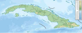
| Géolocalisation sur la carte : Cuba
Géolocalisation sur la carte : océan Atlantique
Géolocalisation sur la carte : Caraïbes
| ||||
| Île de Cuba | ||||
| modifier |
||||
Cayo Cruz del Padre est une caye inhabitée située dans l'océan Atlantique, sur le littoral nord de Cuba. Elle appartient administrativement à la Province de Matanzas. L'île fait partie de l'archipel Sabana-Camagüey.
Patrimoine naturel
[modifier | modifier le code]La réserve écologique (Reserva Ecológica) « Cayo Mono-Galindo », créée en 2006, s'étend (d'ouest en est) sur les municipalités de Varadero, Cárdenas et Martí. Sa surface est de 19 524,91 ha, dont 3 088,06 ha de zones terrestres et 16 436,85 ha de zones marines. Elle inclut, d'ouest en est : le cayo Piedras, à environ 5 km N-N-E de la pointe de la péninsule de Hicacos (Varadero) ; le cayo Blanco — mais pas les cayos Careneros au sud où se trouve le parc à dauphins dit « Cayo Blanco » —, qui forme la pointe sud de la réserve ; et le cayo Cruz del Padre, y compris le minuscule cayo Galindito au nord de sa pointe orientale[1],[2].
Notes et références
[modifier | modifier le code]- (es) Cet article est partiellement ou en totalité issu de l’article de Wikipédia en espagnol intitulé « Cayo Cruz del Padre » (voir la liste des auteurs).
- [Ruiz et al. 2019] (es) I. Ruiz-Plasencia, J. Hernández-Albernas et E. Ruiz-Rojas, chap. 3 (Región occidental) « Catálogo de las áreas protegidas de Cuba », dans I. Ruiz (ed.), Las áreas protegidas de Cuba (avec cartes sommaires pour chaque aire protégée), Centro Nacional de Áreas Protegidas, , 386 p. (lire en ligne [PDF] sur researchgate.net), p. 27-28.
- « Réserve écologique Cayo Mono-Galindo », carte, sur openstreetmap.org. Voir aussi la carte dans Ruiz et al. 2019, p. 28.
Voir aussi
[modifier | modifier le code]Articles connexes
[modifier | modifier le code]Lien externe
[modifier | modifier le code]- (es) « Cayo Cruz del Padre », sur es.getamap.net (consulté en ).
Text is available under the CC BY-SA 4.0 license; additional terms may apply.
Images, videos and audio are available under their respective licenses.


