Arrondissement administratif de La Louvière
| Arrondissement administratif de La Louvière | |
 Localisation de l'arrondissement au sein de sa province | |
| Administration | |
|---|---|
| Pays | |
| Région | |
| Province | |
| Démographie | |
| Population | 142 019 hab. (01/01/2024[1]) |
| Densité | 647 hab./km2 |
| Géographie | |
| Coordonnées | 50° 26′ 04″ nord, 4° 09′ 31″ est |
| Superficie | 219,45 km2 |
| Autres informations | |
| Communes | 4 |
| Sections | 30 |
| Code INS | 58000 |
| modifier |
|
L'arrondissement administratif de La Louvière est un des sept arrondissements administratifs de la province de Hainaut en Région wallonne (Belgique).
Créé en janvier 2018, sa création devient effective le [2]. Sa superficie est de 219,45 km2 et sa population au s’élevait à 142 019 habitants[1], soit une densité de population de 647,16 habitants/km².
L'arrondissement administratif de La Louvière comprend, les communes de Binche, Estinnes, La Louvière et de Morlanwelz. Il forme à lui seul un district électoral comprenant deux cantons électoraux, ceux de La Louvière et de Binche.
Cet arrondissement administratif fait partie de l'arrondissement judiciaire du Hainaut.
Histoire
[modifier | modifier le code]L'arrondissement est créé par décret du modifiant des articles relatifs au code de la démocratie locale et de la décentralisation de la région wallonne[2],[3]. L'arrondissement devient effectif le .
Il regroupe les communes de Binche, Estinnes, La Louvière et de Morlanwelz qui sont détachées de l'arrondissement administratif de Thuin, sauf La Louvière qui vient de l'arrondissement administratif de Soignies.
Il est le huitième arrondissement administratif créé dans la province belge de Hainaut[4].
Communes et leurs sections
[modifier | modifier le code]- Binche
- Boussoit
- Bray
- Buvrinnes
- Carnières
- Croix-lez-Rouveroy
- Épinois
- Estinnes-au-Mont
- Estinnes-au-Val
- Faurœulx
- Haine-Saint-Paul
- Haine-Saint-Pierre
- Haulchin
- Houdeng-Aimeries
- Houdeng-Goegnies
- Leval-Trahegnies
- Maurage
- Mont-Sainte-Aldegonde
- Morlanwelz-Mariemont
- Péronnes-lez-Binche
- Peissant
- Ressaix
- Rouveroy
- Saint-Vaast
- Strépy-Bracquegnies
- Trivières
- Vellereille-le-Sec
- Vellereille-les-Brayeux
- Waudrez
Démographie
[modifier | modifier le code]Évolution démographique depuis la création de cet arrondissement
[modifier | modifier le code]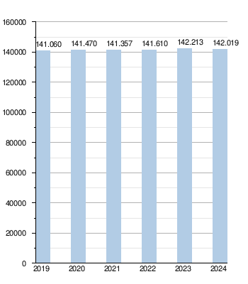
Évolution démographique historique de cet arrondissement
[modifier | modifier le code]
Tous les chiffres concernent les communes de l'arrondissement actuel érigé au 1 janvier 2019.
- Source : INS - Remarque : 1831 - 1970 = recensements ; à partir de 1980 = population au 1er janvier[1]
| Année | Population | Évolution: 1992=index 100 | Évolution: 2019=index 100 |
|---|---|---|---|
| 1992 | 134 923 | 100,0 | |
| 1993 | 135 449 | 100,4 | |
| 1994 | 135 456 | 100,4 | |
| 1995 | 135 419 | 100,4 | |
| 1996 | 135 037 | 100,1 | |
| 1997 | 134 989 | 100,0 | |
| 1998 | 134 856 | 100,0 | |
| 1999 | 135 011 | 100,1 | |
| 2000 | 134 708 | 99,8 | |
| 2001 | 134 741 | 99,9 | |
| 2002 | 134 883 | 100,0 | |
| 2003 | 134 776 | 99,9 | |
| 2004 | 134 857 | 100,0 | |
| 2005 | 135 096 | 100,1 | |
| 2006 | 135 627 | 100,5 | |
| 2007 | 136 148 | 100,9 | |
| 2008 | 136 608 | 101,2 | |
| 2009 | 136 866 | 101,4 | |
| 2010 | 137 299 | 101,8 | |
| 2011 | 137 788 | 102,1 | |
| 2012 | 138 644 | 102,8 | |
| 2013 | 139 340 | 103,3 | |
| 2014 | 140 128 | 103,9 | |
| 2015 | 140 403 | 104,1 | |
| 2016 | 140 651 | 104,2 | |
| 2017 | 141 013 | 104,5 | |
| 2018 | 140 969 | 104,5 | |
| 2019 | 141 060 | 104,5 | 100,0 |
| 2020 | 141 470 | 104,9 | 100,3 |
| 2021 | 141 357 | 104,8 | 100,2 |
| 2022 | 141 610 | 105,0 | 100,4 |
| 2023 | 142 213 | 105,4 | 100,8 |
| 2024 | 142 019 | 105,3 | 100,7 |
Notes et références
[modifier | modifier le code]- https://view.officeapps.live.com/op/view.aspx?src=https%3A%2F%2Fstatbel.fgov.be%2Fsites%2Fdefault%2Ffiles%2Ffiles%2Fdocuments%2Fbevolking%2F5.1%2520Structuur%2520van%2520de%2520bevolking%2FPopulation_par_commune.xlsx&wdOrigin=BROWSELINK
- « Décret du modifiant les articles L1332-18 et L2212-6 ainsi que l'annexe 3 du Code de la démocratie locale et de la décentralisation (Numac: 2018200534) », sur Le Moniteur belge, (consulté le ).
- « Modification du découpage des arrondissements administratifs de la Wallonie en 2018-2019 », sur iweps.be, Iweps (consulté le ).
- Le décret du fusionne les arrondissements administratifs de Tournai et de Mouscron pour former l'arrondissement administratif de Tournai-Mouscron pour le .
Text is available under the CC BY-SA 4.0 license; additional terms may apply.
Images, videos and audio are available under their respective licenses.
