Alto Orinoco
| Alto Orinoco | |
 Le Cerro Duida | |
| Administration | |
|---|---|
| Pays | |
| État | |
| Nombre de paroisses | 5 |
| Chef-lieu | La Esmeralda |
| Maire | Jaime Turon |
| Démographie | |
| Population | 12 687 hab. (2011) |
| Densité | 0,26 hab./km2 |
| Géographie | |
| Coordonnées | 3° 10′ 26″ nord, 65° 32′ 48″ ouest |
| Superficie | 4 921 700 ha = 49 217 km2 |
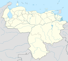
| Localisation | |

| |
| Sources | |
| Municipalités du Venezuela | |
| modifier |
|
Alto Orinoco est l'une des sept municipalités de l'État d'Amazonas au Venezuela. Son chef-lieu est La Esmeralda. En 2011, la population s'élève à 12 687 habitants[1].
Étymologie
[modifier | modifier le code]Alto Orinoco signifie « Haut Orénoque » en espagnol, du fait de sa situation en amont du fleuve Orénoque (río Orinoco, en espagnol).
Histoire amérindienne
[modifier | modifier le code]Le Watunna (publié en espagnol en 1970 puis en anglais dans les années 1980) est l’histoire épique et des mythes de la création des amérindiens Makiritare ou Yekuana dont le territoire est situé le long des berges nord de l'Orénoque supérieur au Venezuela ; région de montagnes et de forêts vierges longtemps restée inexplorée[2].
Géographie
[modifier | modifier le code]Subdivisions
[modifier | modifier le code]La municipalité est divisée en 5 paroisses civiles depuis le selon les documents émanant de l'Institut national des statistiques du Venezuela en 2013, mais seulement 4 paroisses civiles sur les documents émanant du même institut pour l'année 2015, celle de Capital Alto Orinoco n'apparaissant plus comme telle, possible confusion avec le chef-lieu de la municipalité, La Esmeralda dans les sources antérieures. Chacune est dotée d'une capitale à sa tête (entre parenthèses) :
- Huachamacare (Acanaña) ;
- Marawaka (Toky-Shamanaña) ;
- Mavaca (Mavaca) ;
- Sierra Parima (Parimabé).
Notes et références
[modifier | modifier le code]- « Estado Amazonas », sur Instituto Nacional de Estadística (consulté le )
- Marc de Civrieux (2010) Watunna: An Orinoco Creation Cycle ; University of Texas Press, 28 juin 2010 - 235 pages
Text is available under the CC BY-SA 4.0 license; additional terms may apply.
Images, videos and audio are available under their respective licenses.


