Allée couverte d'Er-Roh
| Allée couverte d'Er-Roh | |||||
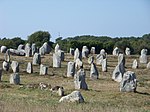
 L'allée couverte d'Er-Roh. | |||||
| Présentation | |||||
|---|---|---|---|---|---|
| Nom local | Allée couverte de Mané Roullarde | ||||
| Type | Allée couverte | ||||
| Période | Néolithique | ||||
| Protection | |||||
| Visite | Propriété privée[Note 1] | ||||
| Caractéristiques | |||||
| Géographie | |||||
| Coordonnées | 47° 35′ 28″ nord, 3° 01′ 56″ ouest | ||||
| Pays | |||||
| Région | Bretagne | ||||
| Département | Morbihan | ||||
| Commune | La Trinité-sur-Mer | ||||
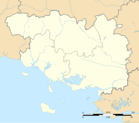
| Géolocalisation sur la carte : alignements de Carnac
Géolocalisation sur la carte : arrondissement de Lorient
Géolocalisation sur la carte : Morbihan
Géolocalisation sur la carte : Bretagne (région administrative)
| |||||
| modifier |
|||||
L'allée couverte d'Er-Roh, appelée aussi allée couverte de Mané Roullarde, est une allée couverte située sur la commune de La Trinité-sur-Mer.
Historique
[modifier | modifier le code]Le monument a été classé monument historique depuis 1929 par arrêté du 11 septembre 1929}[1]. Il a été restauré par Z. Le Rouzic en 1930[2].
Description
[modifier | modifier le code]Le monument mesure environ 19,40 m de longueur sur 1,10 à 1,60 m de large. Il comporte encore quatre tables de couverture[2].
Notes et références
[modifier | modifier le code]Notes
[modifier | modifier le code]- Visible de la route, demander la clef aux propriétaires pour y accéder.
Références
[modifier | modifier le code]- « Allée couverte d'Er-Roh », notice no PA00091766, sur la plateforme ouverte du patrimoine, base Mérimée, ministère français de la Culture
- Laville 2023.
Voir aussi
[modifier | modifier le code]Articles connexes
[modifier | modifier le code]Autres projets
[modifier | modifier le code]Bibliographie
[modifier | modifier le code]- Grégoire Laville, Terre de mégalithes : Carnac et les rives du Mobihan, Rennes, Éditions Ouest-France, , 139 p. (ISBN 9782737388927), p. 51-53
Text is available under the CC BY-SA 4.0 license; additional terms may apply.
Images, videos and audio are available under their respective licenses.


