Tiedosto:Weir from the Caledonian Canal - geograph.org.uk - 488466.jpg
Wikipediasta
Tarkempaa kuvaa ei ole saatavilla.
Weir_from_the_Caledonian_Canal_-_geograph.org.uk_-_488466.jpg (640 × 479 kuvapistettä, 402 KiB, MIME-tyyppi: image/jpeg)
| Tämä tiedosto on tiedostotietokanta Wikimedia Commonsista. Tiedot kuvaussivulta näkyvät alla. |  |
Tiedoston kuvaussivu Commonsissa |
Yhteenveto
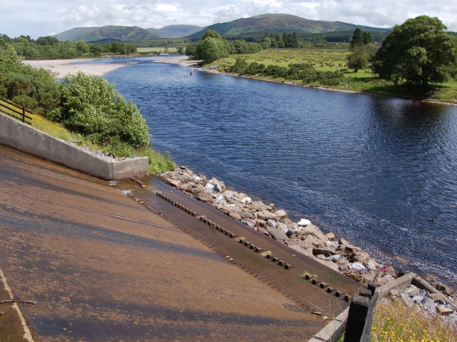
| Kuvaus |
English: Weir from the Caledonian Canal This weir carries overflow from the canal (out of shot to the left) down to the River Lochy. |
| Päiväys | |
| Lähde | From geograph.org.uk |
| Tekijä | John Allan |
| Nimeä (lisenssin vaatima) | John Allan / Weir from the Caledonian Canal / |
| Kameran sijainti | | Tämä ja muut kuvat kartalla: OpenStreetMap |
|---|
| Kohteen sijainti | | Tämä ja muut kuvat kartalla: OpenStreetMap |
|---|
Lisenssi

|
Tämä kuva on otettu Geograph British Isles -projektin kokoelmasta ja sen tekijänoikeuksien haltija on John Allan. Katso valokuvan sivu valokuvaajan yhteystietoja varten. John Allan.
|
Tämä tiedosto on lisensoitu Creative Commons Nimeä-JaaSamoin 2.0 Yleinen -lisenssillä.
Nimeä: John Allan
- Voit:
- jakaa – kopioida, levittää ja esittää teosta
- remiksata – valmistaa muutettuja teoksia
- Seuraavilla ehdoilla:
- nimeäminen – Sinun on mainittava lähde asianmukaisesti, tarjottava linkki lisenssiin sekä merkittävä, mikäli olet tehnyt muutoksia. Voit tehdä yllä olevan millä tahansa kohtuullisella tavalla, mutta et siten, että annat ymmärtää lisenssinantajan suosittelevan sinua tai teoksen käyttöäsi.
- jaa samoin – Jos muutat tai perustat tähän työhön, voit jakaa tuloksena syntyvää työtä vain tällä tai tämän kaltaisella lisenssillä.
Tiedoston historia
Päiväystä napsauttamalla näet, millainen tiedosto oli kyseisellä hetkellä.
| Päiväys | Pienoiskuva | Koko | Käyttäjä | Kommentti | |
|---|---|---|---|---|---|
| nykyinen | 5. helmikuuta 2011 kello 06.17 | | 640 × 479 (402 KiB) | GeographBot | == ((int:filedesc)) == ((Information |description=((en|1=Weir from the Caledonian Canal This weir carries overflow from the canal (out of shot to the left) down to the River Lochy.)) |date=2007-07-03 |source=From [http://www.geograph.org.uk/photo/488466 g |
Tiedoston käyttö
Seuraava sivu käyttää tätä tiedostoa:
Tiedoston järjestelmänlaajuinen käyttö
Seuraavat muut wikit käyttävät tätä tiedostoa:
- Käyttö sivustolla ceb.wikipedia.org
- Käyttö sivustolla en.wikipedia.org
- Käyttö sivustolla www.wikidata.org
Metatieto
Text is available under the CC BY-SA 4.0 license; additional terms may apply.
Images, videos and audio are available under their respective licenses.
Cover photo is available under {{::mainImage.info.license.name || 'Unknown'}} license.
Cover photo is available under {{::mainImage.info.license.name || 'Unknown'}} license.
Credit:
(see original file).
