Fjugesta
Wikipediasta
| Fjugesta | |
|---|---|
 Fjugestan tori. |
|
 Fjugesta |
|
|
Koordinaatit: |
|
| Valtio |
|
| Lääni | Örebron lääni |
| Maakunta | Närke |
| Kunta | Lekebergin kunta |
| Pinta-ala | |
| – Maa | 2,09 km² |
| Väkiluku | 2 033 |
| – Väestötiheys | 972,7 as./km² |
|
Tilastotiedot koskevat taajamaa ja niiden lähteenä on Statistiska centralbyrån (SCB). Väkiluku ja maapinta-ala ovat ajankohdan 31.12.2010 mukaiset.[1]
|
|
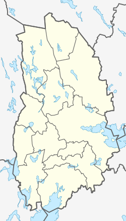
Fjugesta on Lekebergin kunnan keskustaajama. Se sijaitsee Örebron läänissä ja Närken historiallisessa maakunnassa Keski-Ruotsissa. Vuoden 2010 lopussa taajamassa oli 2 033 asukasta.[2]
Fjugesta on entinen taajaväkinen yhdyskunta. Siellä sijaitsee Knistan kirkko.
Väestönkehitys
[muokkaa | muokkaa wikitekstiä]| Fjugestan taajaman väestönkehitys 1960–2010 | ||||
|---|---|---|---|---|
| Vuosi | Asukkaita | |||
| 1960 | 1 415 | |||
| 1965 | 1 448 | |||
| 1970 | 1 708 | |||
| 1975 | 1 916 | |||
| 1980 | 1 933 | |||
| 1990 | 2 014 | |||
| 1995 | 2 038 | |||
| 2000 | 1 992 | |||
| 2005 | 2 063 | |||
| 2010 | 2 033 | |||
| Lähde: Statistiska centralbyrån (SCB).[3] | ||||
Lähteet
[muokkaa | muokkaa wikitekstiä]- ↑ Tätorter 2010, korrigerad version 2012-11-14 (PDF) MI38 Småorter och tätorter. 14.11.2012. Statistiska centralbyrån. Viitattu 23.11.2012. (ruotsiksi)
- ↑ Landareal, folkmängd och invånartäthet (inv/km2), per tätort 2005 och 2010 (XLS) 28.5.2012. Statistiska centralbyrån. Viitattu 15.11.2012. (ruotsiksi)
- ↑ Befolkning i tätorter 1960-2010 (XLS) 29.5.2012. Statistiska centralbyrån. Viitattu 12.12.2012. (ruotsiksi)

Örebron läänin kuntien keskustaajamat
| Askersund • Degerfors • Fjugesta (Lekebergin kunta) • Hallsberg • Hällefors • Karlskoga • Kopparberg (Ljusnarsbergin kunta) • Kumla • Laxå • Lindesberg • Nora • Örebro |
| Katso myös: Luettelo Ruotsin taajamista • Luettelo Ruotsin kunnista |
Text is available under the CC BY-SA 4.0 license; additional terms may apply.
Images, videos and audio are available under their respective licenses.
Cover photo is available under {{::mainImage.info.license.name || 'Unknown'}} license.
Cover photo is available under {{::mainImage.info.license.name || 'Unknown'}} license.
Credit:
(see original file).
