پل وستمینستر
پل وستمینستر | |
|---|---|
 | |
| مختصات | ۵۱°۳۰′۰۳″شمالی ۰°۰۷′۱۹″غربی / ۵۱٫۵۰۰۸°شمالی ۰٫۱۲۱۹°غربی |
| گذرندهها | جاده ای۳۰۲ |
| بر روی | تیمز |
| مکان | لندن، انگلستان، بریتانیا |
| وضعیت میراث | بنای فهرست شده |
| پیش از | پل لمبت |
| پس از | پل هانگرفورد و پل گلدن جوبیلی |
| ویژگیها | |
| طراحی | پل قوسی |
| درازای کل | ۸۲۰ فوت (۲۵۰ متر) |
| پهنا | ۸۵ فوت (۲۶ متر) |
| شمار دهنهها | ۷ |
| پیشینه | |
| طراح | توماس پیج |
| گشایش | ۲۴ مه ۱۸۶۲ |
| مکان | |
 | |
پل وستمینستر (به انگلیسی: Westminster Bridge) یک پل روی تیمز در لندن است.
این پل که در تاریخ ۲۴ مه ۱۸۶۲ به بهرهبرداری رسیده دارای ۲۵۰ متر طول و ۲۶ متر عرض میباشد.
نگارخانه
[ویرایش]-
 نقاشی اولین پل وستمینستر اثر کانالتو، ۱۷۴۷
 -
 نقاشی پل وستمینستر، ۱۷۵۰
 -
 پل وستمینستر در نقشه ۱۸۹۷
 -
 چراغهای پل
 -
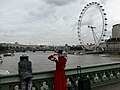 هنرمندان خیابانی بر روی پل وستمینستر
 -
 روی پل
 -
 روی پل


.jpg)

پانویس
[ویرایش]- Westminster Bridge (1750) در وبگاه structurae.de
- Westminster Bridge (1862) در وبگاه structurae.de
- Interactive Panorama: Westminster Bridge
در ویکیانبار پروندههایی دربارهٔ پل وستمینستر موجود است.
Text is available under the CC BY-SA 4.0 license; additional terms may apply.
Images, videos and audio are available under their respective licenses.
Cover photo is available under {{::mainImage.info.license.name || 'Unknown'}} license.
Cover photo is available under {{::mainImage.info.license.name || 'Unknown'}} license.
Credit:
(see original file).
