پرونده:Planisphæri cœleste.jpg
اندازهٔ این پیشنمایش: ۸۰۰ × ۵۴۷ پیکسل. کیفیتهای دیگر: ۳۲۰ × ۲۱۹ پیکسل | ۶۴۰ × ۴۳۷ پیکسل | ۱٬۰۲۴ × ۷۰۰ پیکسل | ۱٬۲۸۰ × ۸۷۵ پیکسل | ۲٬۵۶۰ × ۱٬۷۵۰ پیکسل | ۵٬۸۱۲ × ۳٬۹۷۲ پیکسل.
پروندهٔ اصلی (۵٬۸۱۲ × ۳٬۹۷۲ پیکسل، اندازهٔ پرونده: ۱۹٫۰۷ مگابایت، نوع MIME پرونده: image/jpeg)
این پرونده در ویکیانبار موجود است. محتویات صفحهٔ توصیف آن در زیر نمایش داده میشود. |
خلاصه
| پدیدآور |
|
|||||||||||||||||||||||||
| توضیح |
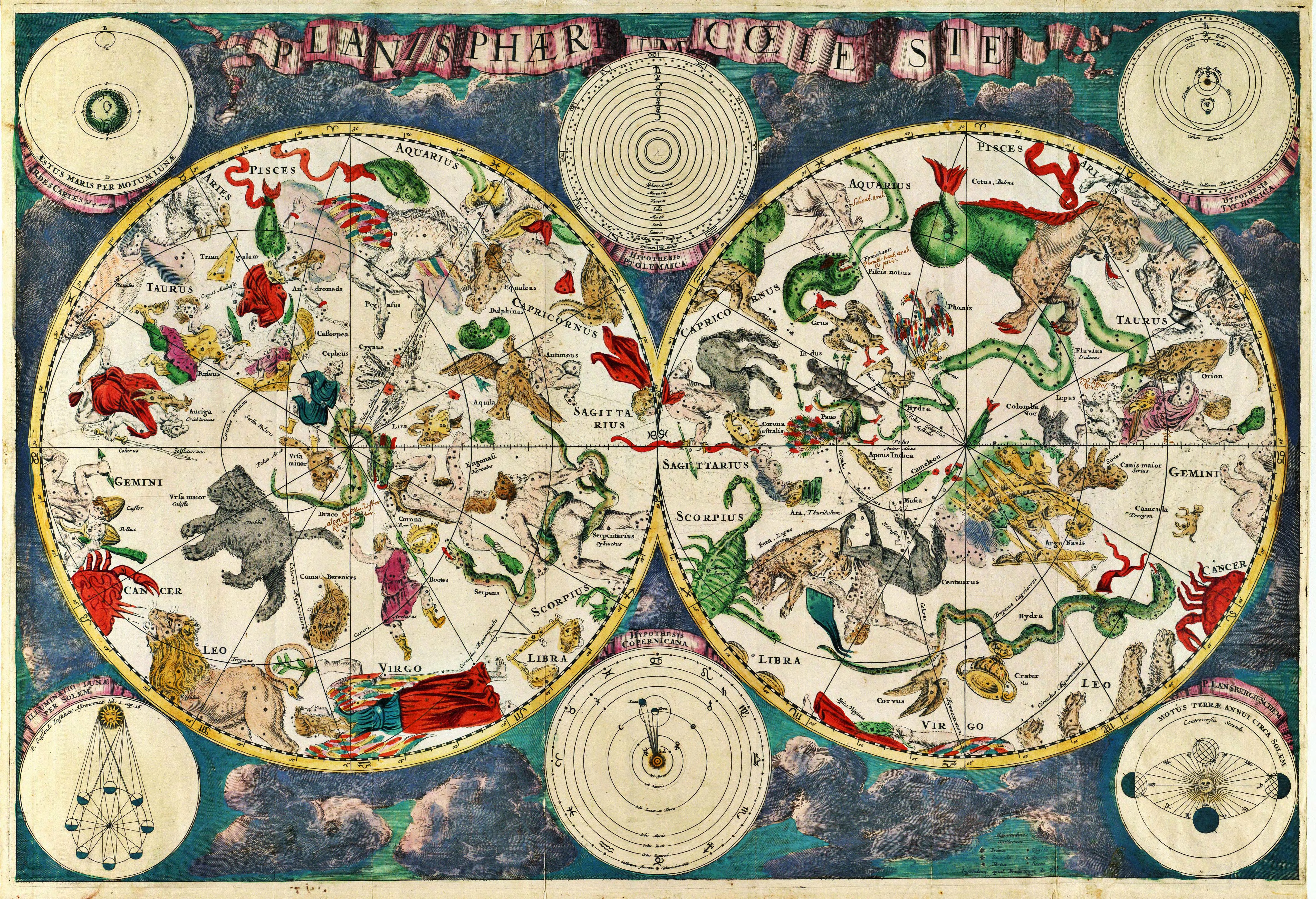
Planisphærium cœleste, denmark, Frederik V English: Celestial map Français : Carte céleste |
|||||||||||||||||||||||||
| تاریخ | ۱۶۷۰ | |||||||||||||||||||||||||
| منابع | Koninklijke Deense Bibliotheek | |||||||||||||||||||||||||
| منبع/عکاس | Transferred from en.wikipedia to Commons. Scanned by Janke | |||||||||||||||||||||||||
سیاهه بارگذاری اصلی
صفحهٔ اصلی توضیحات اینجابود. همهٔ نامهای کاربر زیر به en.wikipedia اشاره دارند.
- 2007-03-10 18:20 Janke 1804×1236×8 (3237455 bytes) Celestial map from the 17th century, by the Dutch cartographer Frederik de Wit. Scanned by uploader
اجازهنامه
|
این اثر هنری دوبعدی که در این نگاره دیده میشود بخاطر تاریخ درگذشت پدیدآورنده آن یا تاریخ انتشارش هماکنون در سراسر جهان در مالکیت عمومی قرار دارد و استفاده از آن آزاد است.
بنابراین تکثیر آن در ایالات متحده آمریکا، آلمان و بسیاری کشورهای دیگر آزاد است.
| ||||
تاریخچهٔ پرونده
روی تاریخ/زمانها کلیک کنید تا نسخهٔ مربوط به آن هنگام را ببینید.
| تاریخ/زمان | بندانگشتی | ابعاد | کاربر | توضیح | |
|---|---|---|---|---|---|
| کنونی | ۲۳ دسامبر ۲۰۱۰، ساعت ۱۰:۰۱ | | ۵٬۸۱۲ در ۳٬۹۷۲ (۱۹٫۰۷ مگابایت) | Joopr | Hogere resolutie |
| ۲۹ مهٔ ۲۰۰۷، ساعت ۰۰:۱۸ |  | ۱٬۸۰۴ در ۱٬۲۳۶ (۳٫۰۹ مگابایت) | STyx | ((Information |Description= ((la))Planisphæri cœleste ((en))Celestial map from the 17th century, by the Dutch cartographer Frederik de Wit. ((fr))Carte céleste du XVII ème siècle, réalisée par le cartographe hollandais Frederik de Wit. ((du))[http |
کاربرد پرونده
صفحهٔ زیر از این تصویر استفاده میکند:
کاربرد سراسری پرونده
ویکیهای دیگر زیر از این پرونده استفاده میکنند:
- کاربرد در ar.wikipedia.org
- کاربرد در ar.wikibooks.org
- کاربرد در ast.wikipedia.org
- کاربرد در az.wikipedia.org
- کاربرد در ba.wikipedia.org
- کاربرد در bg.wikipedia.org
- کاربرد در bn.wikipedia.org
- کاربرد در ca.wikipedia.org
- کاربرد در cbk-zam.wikipedia.org
- کاربرد در ce.wikipedia.org
- کاربرد در cs.wikipedia.org
- کاربرد در de.wikipedia.org
- کاربرد در el.wikipedia.org
- کاربرد در en.wikipedia.org
- Constellation
- Map
- Astronomy
- Natural philosophy
- Star chart
- Wikipedia:Featured picture candidates/March-2007
- Wikipedia:Featured picture candidates/17th century star map
- User:Sj/olpc dictionary images/500
- Portal:Maps/Maps/Historical
- Portal:Maps/Maps/Historical/7
- Talk:Astronomy/Archive 2
- Wikipedia:Wikipedia Signpost/2013-01-14/WikiProject report
- Wikipedia:Wikipedia Signpost/Single/2013-01-14
- کاربرد در en.wikiquote.org
- کاربرد در eo.wikipedia.org
- کاربرد در es.wikipedia.org
- کاربرد در fi.wikipedia.org
- کاربرد در fr.wikipedia.org
- کاربرد در gl.wikipedia.org
نمایش استفادههای سراسری از این پرونده.
فراداده
Text is available under the CC BY-SA 4.0 license; additional terms may apply.
Images, videos and audio are available under their respective licenses.
Cover photo is available under {{::mainImage.info.license.name || 'Unknown'}} license.
Cover photo is available under {{::mainImage.info.license.name || 'Unknown'}} license.
Credit:
(see original file).
