تسار
تسار
Ծար | |
|---|---|
 | |
 تسار | |
| مختصات: ۴۰°۰۰′۱۹″ شمالی ۴۵°۵۷′۰۸″ شرقی / ۴۰٫۰۰۵۲۸°شمالی ۴۵٫۹۵۲۲۲°شرقی | |
| کشور | |
| استان شهرستان | استان شاهومیان شهرستان کلبجر |
| جمعیت (سرشماری ۲۰۰۵) | |
| • کل | ۵۲ |
| منطقهٔ زمانی | یوتیسی +۴ |
| • تابستانی (DST) | یوتیسی +۵ |
تسار (به ارمنی: Ծար) یک منطقهٔ مسکونی در جمهوری آرتساخ است که در استان شاهومیان واقع شدهاست. [۱] تسار ۵۲ نفر جمعیت دارد.
نگارخانه
[ویرایش]-
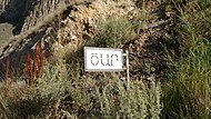 A sign in Armenian denoting the boundary limit of Tsar.
 -
 A monument built in honor of the Armenian troops who died in the Nagorno-Karabakh War.
 -
 One of canyons that surround the village.
 -
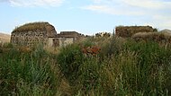
 Ruins of the village school built in the 1950s and containing stones taken from an Armenian monastery..
 -
 Fragments of Armenian gravestones.
 -
 Ruins of Armenian churches.
 -
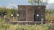
 Ornaments on the wall of the Chapel of St. Sargis.
 -


جستارهای وابسته
[ویرایش]منابع
[ویرایش]- باغداساریان، ادیک (۱۳۸۰). تاریخ آرتساخ (قرهباغ): از دیرباز تا سال ۱۹۹۱. تهران. شابک ۹۶۴-۰۶-۰۷۴۲-۸.
- https://artsakhlib.am/2018/06/06/տեղեկատու-լղհ-վարչատարածքային-միավո/
- "47-68.xls - Census" (PDF).
((cite web)): Cite has empty unknown parameter:|registration=(help)
پیوند به بیرون
[ویرایش]مرکز: کارواجار | ||
| جوامع شهری |  | |
| جوامع روستایی |
| |

- ↑ مشارکتکنندگان ویکیپدیا. «Zar, Azerbaijan». در دانشنامهٔ ویکیپدیای انگلیسی.
Text is available under the CC BY-SA 4.0 license; additional terms may apply.
Images, videos and audio are available under their respective licenses.
Cover photo is available under {{::mainImage.info.license.name || 'Unknown'}} license.
Cover photo is available under {{::mainImage.info.license.name || 'Unknown'}} license.
Credit:
(see original file).
