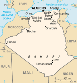
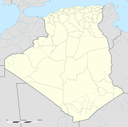
الگو:Location map Algeria/توضیحات
| این زیرصفحهٔ مستندات الگو:Location map Algeria است. این شامل اطلاعات استفاده، الگوها، پیوندهای بین زبانی و سایر اطلاعات است که در اصل الگو صفحه قرار نمیگیرد. |

Template:Location map Algeria is a location map definition used to overlay markers and labels on an equirectangular projection map of الجزایر. The markers are placed by عرض جغرافیایی and طول جغرافیایی coordinates on the default map or a similar map image.
Usage
[ویرایش]These definitions are used by the following templates when invoked with parameter "Algeria":
((Location map|Algeria |...))((Location map many|Algeria |...))((Location map+|Algeria |...))((Location map~|Algeria |...))
Map definition
[ویرایش]- name = الجزایر
- Name used in the default map caption
- image = Algeria location map.svg
- The default map image, without "Image:" or "File:"
- image1 = Algeria relief location map.jpg
- An alternative map image, usually a relief map, can be displayed via the relief or AlternativeMap parameters
- top = 37.8
- عرض جغرافیایی at top edge of map, in decimal degrees
- bottom = 18.25
- Latitude at bottom edge of map, in decimal degrees
- left = -9.45
- طول جغرافیایی at left edge of map, in decimal degrees
- right = 12.75
- Longitude at right edge of map, in decimal degrees
Alternative map
The map defined as image1 (Algeria relief location map.jpg) can be displayed by using the relief or AlternativeMap parameters in ((Location map)), ((Location map many)) and ((Location map+)). The use of these two parameters is shown in the examples below. Additional examples can be found at:
Examples using location map templates
[ویرایش]Location map, using default map (image)
[ویرایش]((Location map | Algeria | width = 180 | lat_deg = 36.7 | lon_deg = 3.22 | label = Algiers ))
Location map many, using relief map (image1)
[ویرایش]((Location map many | Algeria | relief = yes | width = 180 | caption = Two locations in Algeria | lat1_deg = 36.7 | lon1_deg = 3.22 | label1 = Algiers | pos1 = bottom | lat2_deg = 22.79 | lon2_deg = 5.52 | label2 = Tamanrasset | pos2 = bottom ))
Location map+, using AlternativeMap
[ویرایش]
((Location map+ | Algeria
| AlternativeMap = Algeria relief location map.jpg
| width   = 180
| caption = Two locations in Algeria
| places  =
  ((Location map~ | Algeria
  | lat_deg  = 36.7
  | lon_deg  = 3.22
  | label    = Algiers
  | position = bottom
  ))
  ((Location map~ | Algeria
  | lat_deg  = 22.79
  | lon_deg  = 5.52
  | label    = Tamanrasset
  | position = bottom
  ))
))
See also
[ویرایش]- Template:Location map Algeria relief, displays the relief map shown above (for infoboxes that do not support alternative maps)
- Location map templates
- Template:Location map, to display one mark and label using latitude and longitude
- Template:Location map many, to display up to nine marks and labels
- Template:Location map+, to display an unlimited number of marks and labels
- Infobox templates incorporating (passing values to) the Location map template
- Template:Infobox airport — alternative map support: AlternativeMap (via pushpin_image)
- Template:Infobox archaeological site
- Template:Infobox artwork
- الگو:جعبه اطلاعات ساختمان
- Template:Infobox casino
- الگو:جعبه سد
- Template:Infobox glacier (via Infobox mountain/map)
- Template:Infobox historic area
- Template:Infobox historic site
- Template:Infobox hot spring (via Infobox map) — alternative map support: relief
- Template:Infobox hotel
- Template:Infobox map (used by other infoboxes) — alternative map support: relief
- Template:Infobox military structure
- Template:Infobox monastery
- الگو:دادان کوه (via Infobox mountain/map)
- Template:Infobox mountain/map (used by mountain, glacier)
- Template:Infobox park (via Infobox map) — alternative map support: relief
- الگو:جعبه اطلاعات منطقه حفاظتشده (via Infobox map) — alternative map support: relief
- الگو:Infobox settlement — alternative map support: AlternativeMap (via pushpin_image)
- Template:Infobox valley (via Infobox map)
- الگو:جعبه اطلاعات آبشار (via Infobox map) — alternative map support: relief
- Template:Infobox World Heritage Site — alternative map support: relief
Text is available under the CC BY-SA 4.0 license; additional terms may apply.
Images, videos and audio are available under their respective licenses.


