Yamagata (Yamagata)
| Yamagata 山形市 | ||||
|---|---|---|---|---|
| Ciudad especial | ||||
 | ||||
|
Localización de Yamagata en Japón | ||||
 | ||||
| Coordenadas | 38°15′20″N 140°20′23″E / 38.255416666667, 140.33961111111 | |||
| Idioma oficial | Japonés | |||
| Entidad | Ciudad especial | |||
| • País | Japón | |||
| • Región | Tōhoku | |||
| • Prefectura | Yamagata | |||
| Dirigentes | ||||
| • Alcalde | Akio Ichikawa | |||
| Superficie | ||||
| • Total | 381 km² | |||
| Altitud | ||||
| • Media | 120 m s. n. m. | |||
| Población (2011) | ||||
| • Total | 254 146 hab. | |||
| • Densidad | 660 hab./km² | |||
| Huso horario | Hora estándar de Japón (UTC +9) | |||
| Código dantai | 062014[1][2] | |||
| Flor | Carthamus tinctorius | |||
| Árbol | Sorbus commixta | |||
| Sitio web oficial | ||||
 | ||||
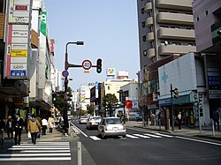
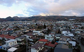
La ciudad de Yamagata (山形市 Yamagata-shi?) es una ciudad que se encuentra en la prefectura de Yamagata, en el centro-oeste de la región de Tohoku en el norte de Japón. Es la capital de la prefectura. Habitan 255 000 personas.
Clima
[editar]La ciudad de Yamagata tuvo el récord de la temperatura más alta jamás registrada en Japón (40,8 ˚C el 25 de julio de 1933) hasta que el récord fue superado por dos ciudades (40,9 ˚C en Kumagaya y Tajimi) el 16 de agosto de 2007[3]
| Mes | Ene. | Feb. | Mar. | Abr. | May. | Jun. | Jul. | Ago. | Sep. | Oct. | Nov. | Dic. | Anual |
|---|---|---|---|---|---|---|---|---|---|---|---|---|---|
| Temp. máx. media (°C) | 3.1 | 4.0 | 8.4 | 16.2 | 22.0 | 25.4 | 28.4 | 30.4 | 25.2 | 19.0 | 12.2 | 6.4 | 16.7 |
| Temp. media (°C) | -0.4 | 0.1 | 3.5 | 10.1 | 15.7 | 19.8 | 23.3 | 24.9 | 20.1 | 13.6 | 7.4 | 2.6 | 11.7 |
| Temp. mín. media (°C) | −3.4 | −3.3 | −0.7 | 4.5 | 10.1 | 15.2 | 19.4 | 20.7 | 16.2 | 9.2 | 3.2 | −0.7 | 7.5 |
| Precipitación total (mm) | 83.0 | 62.7 | 68.6 | 68.4 | 75.4 | 110.5 | 157.0 | 150.8 | 127.2 | 92.4 | 84.5 | 82.7 | 1163.2 |
| Nevadas (cm) | 148 | 125 | 57 | 3 | 0 | 0 | 0 | 0 | 0 | 0 | 10 | 77 | 420 |
| Días de nevadas (≥ 1 mm) | 26.6 | 22.2 | 16.5 | 2.5 | 0 | 0 | 0 | 0 | 0 | 0 | 4.2 | 18.5 | 90.5 |
| Horas de sol | 84.8 | 98.9 | 140.3 | 176.1 | 191.5 | 158.8 | 143.7 | 178.4 | 128.7 | 132.1 | 99.2 | 80.7 | 1613.2 |
| Humedad relativa (%) | 81 | 77 | 69 | 62 | 65 | 72 | 77 | 75 | 77 | 77 | 78 | 80 | 74.2 |
| Fuente: Japan Meteorological Agency | |||||||||||||
Ciudades hermanadas
[editar] Swan Hill, Victoria, Australia
 Boulder, Colorado, Estados Unidos.
Referencias
[editar]- ↑ Ministerio de Asuntos Internos y Comunicaciones (10 de octubre de 2016). «都道府県コード及び市区町村コード» [Códigos de prefectura y municipales] (PDF) (en japonés). Consultado el 25 de enero de 2018.
- ↑ Ministerio de Asuntos Internos y Comunicaciones (10 de octubre de 2016). «都道府県コード及び市区町村コード» [Códigos de prefectura y municipales] (XLS) (en japonés). Consultado el 25 de enero de 2018.
- ↑ 河北新報. Agos. agosto 17 14:32:05 PDT 2007. Consultado el 8 de 17 de 2007.
Enlaces externos
[editar] Wikimedia Commons alberga una categoría multimedia sobre Yamagata.
- Página oficial de Yamagata en Japonés
- Clima en Ciudad de Yamagata en inglés
Text is available under the CC BY-SA 4.0 license; additional terms may apply.
Images, videos and audio are available under their respective licenses.


