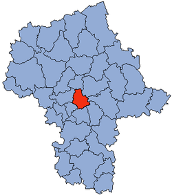
Voivodato de Mazovia
| Voivodato de Mazovia Województwo Mazowieckie | ||||
|---|---|---|---|---|
| Voivodato | ||||
| ||||
 | ||||
| Coordenadas | 52°20′00″N 21°06′00″E / 52.333333333333, 21.1 | |||
| Capital | Varsovia | |||
| Idioma oficial | Polaco | |||
| Entidad | Voivodato | |||
| • País | Polonia | |||
| Voivoda Mariscal |
Leszek Mizielinski Adam Struzik | |||
| Subdivisiones |
Ciudades-distrito 5 Distritos territoriales 37 Municipios urbanos 35 Municipios rururbanos 50 Municipios rurales 229 | |||
| Superficie | ||||
| • Total | 35 597 km² | |||
| Población (2003) | ||||
| • Total | 5 136 000 hab. | |||
| • Densidad | 144,3 hab./km² | |||
| Matrícula | W | |||
| ISO 3166-2 | PL-MZ | |||
| Matrícula | M | |||
| Urbanización | 65% | |||
| Sitio web oficial | ||||

El voivodato de Mazovia (en polaco: Województwo Mazowieckie) es una de las 16 provincias (voivodatos) que conforman la República de Polonia, según la división administrativa del año 1999. Con área de 35 597 km² es el más grande del país y el más importante al tener en su territorio la ciudad distrito de Varsovia, capital polaca.
El voivodato de Mazovia en líneas generales abarca la mayor parte de la región histórica y geográfica llamada Mazovia.
Divisiones
- Ciudades-distrito
- Distritos
 Distrito de Varsovia – 1.700.536
 Distrito de Wołomin – 202.445
 Distrito de Pruszków – 145.870
 Distrito de Radom – 145.276
 Distrito de Piaseczno – 145.253
 Distrito de Mińsk Mazowiecki – 141.048
 Distrito de Otwock – 116.086
 Distrito de Płock – 106.455
 Distrito de Garwolin – 106.227
 Distrito de Ożarów Mazowiecki – 100.965
 Distrito de Legionowo – 96.497
 Distrito de Grójec – 96.489
 Distrito de Ciechanów – 91.049
 Distrito de Płońsk – 87.430
 Distrito de Ostrołęka – 84.344
 Distrito de Sochaczew – 83.318
 Distrito de Siedlce – 80.560
 Distrito de Grodzisk Mazowiecki – 78.208
 Distrito de Nowy Dwór Mazowiecki – 75.736
 Distrito de Ostrów Mazowiecka – 75.073
 Distrito de Żyrardów – 74.662
 Distrito de Mława – 73.452
 Distrito de Wyszków – 71.558
 Distrito de Węgrów – 67.823
 Distrito de Kozienice – 61.614
 Distrito de Sokołów Podlaski – 56.823
 Distrito de Sierpc – 53.811
 Distrito de Przasnysz – 52.948
 Distrito de Pułtusk – 51.033
 Distrito de Gostynin – 47.034
 Distrito de Maków Mazowiecki – 46.474
 Distrito de Przysucha – 43.822
 Distrito de Szydłowiec – 40.083
 Distrito de Żuromin – 40.078
 Distrito de Zwoleń – 37.183
 Distrito de Lipsko – 36.670
 Distrito de Białobrzegi – 33.545
 Distrito de Łosice – 32.770
Text is available under the CC BY-SA 4.0 license; additional terms may apply.
Images, videos and audio are available under their respective licenses.


