Anexo:Organización territorial de San Vicente y las Granadinas

Parroquias
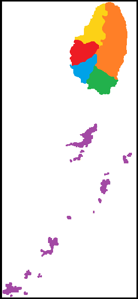
[editar]San Vicente y las Granadinas se divide políticamente en seis parroquias:
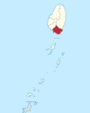
| Parroquia | Nombre local | Área (km²) | Capital | Localización |
|---|---|---|---|---|
| Carlota | Charlotte | 149 | Georgetown | 
|
| Granadinas | Grenadines | 43 | Port Elizabeth | 
|
| San Andrés | Saint Andrew | 29 | Layou | 
|
| San David | Saint David | 80 | Chateaubelair | 
|
| San Jorge | Saint George | 52 | Kingstown | 
|
| San Patricio | Saint Patrick | 37 | Barrouallie | 
|
| TOTAL | 389 | Kingstown | 
|
Todas las parroquias son administradas desde la ciudad de Kingstown, capital del país.
Divisiones censales
[editar]Los resultados censales son presentados por 13 divisiones censales cuyos límites son diferentes a los de las parroquias:
| División censal | Población censo 2012 (hab.)[1] | Localización |
|---|---|---|
| 01-Kingstown | 12 712 | Repartida entre las parroquias de San Andrés y San Jorge |
| 02-Suburbs of Kingstown | 13 782 | Repartida entre las parroquias de San Andrés y San Jorge |
| 03-Calliaqua | 23 908 | Parte de la parroquia de San Jorge |
| 04-Marriaqua | 7798 | Repartida entre las parroquias de Carlota y San Jorge |
| 05-Bridgetown | 6564 | Parte de la parroquia de Carlota |
| 06-Colonarie | 6849 | Parte de la parroquia de Carlota |
| 07-Georgetown | 7049 | Parte de la parroquia de Carlota |
| 08-Sandy Bay | 2576 | Parte de la parroquia de Carlota |
| 09-Layou | 6335 | Parte de la parroquia de San Andrés |
| 10-Barrouallie | 5625 | Parte de la parroquia de San Patricio |
| 11-Chateaubelair | 5756 | Corresponde aprox. con la parroquia de San David |
| TOTAL isla de San Vicente | 98 954 | Corresponde a las 5 parroquias de la isla San Vicente |
| 12-Northern Grenadines | 6184 | Islas Bequia (4946 hab.), Mustique (1238 hab.), incluyendo adyacentes[2] |
| 13-Southern Grenadines | 4050 | Islas Canouan (1638 hab.), Mayreau (271 hab.), Unión (2096 hab.), incluyendo adyacentes[2] |
| TOTAL Granadinas | 10 234 | Corresponde a la parroquia de Granadinas |
| Personas sin hogar, reclusos, psiquiátricos, guarderías y otras internadas | 803 | |
| TOTAL San Vicente y las Granadinas | 109 991 |
Referencias
[editar]Text is available under the CC BY-SA 4.0 license; additional terms may apply.
Images, videos and audio are available under their respective licenses.
