Municipio de Kotor
| Kotor | ||
|---|---|---|
| Municipio | ||
 Escudo | ||
 Localización del municipio en Montenegro. | ||
| Coordenadas | 42°26′00″N 18°46′00″E / 42.43333333, 18.76666667 | |
| Capital | Kotor | |
| Entidad | Municipio | |
| • País |
| |
| Superficie | ||
| • Total | 335 km² | |
| Población (2011) | ||
| • Total | 22 601 hab. | |
| • Densidad | 67 hab./km² | |
| ISO 3166-2 | ME-10 | |
El Municipio de Kotor (italiano: Comune di Cattaro) es uno de los veintitrés municipios en los que se encuentra dividido Montenegro. Su capital es la ciudad de Kotor y su localidad más importante es Dobrota.
Geografía
[editar]El municipio se encuentra situado en la zona del suroeste de Montenegro, limita al norte con el Municipio de Cetiña, al sur con el Mar Adriático y el Municipio de Tivat al este con el Municipio de Budva y al oeste con el de Nikšić, Bosnia y Herzegovina y el Municipio de Herzeg Novi.
Demografía
[editar]El municipio tiene una población de 22.601 habitantes según el último censo realizado en el año 2011, de estos 1.331 habitan en la capital, la ciudad de Kotor que no obstante no es la ciudad más poblada, ya que Dobrota posee una población de 8.473 habitantes por lo que se sitúa como la mayor ciudad del municipio.
Localidades
[editar]Comprende las siguientes localidades (población en 2011):[1]
- Bigova - 101
- Bratešici - 46
- Bunovici - despoblado
- Cavori - despoblado
- Dobrota - 8189
- Donji Morinj - 224
- Donji Orahovac - 298
- Donji Stoliv - 348
- Dragalj - 27
- Dražin Vrt - 64
- Dub - 302
- Glavati - 391
- Glavaticici - 67
- Gornji Morinj - despoblado
- Gornji Orahovac - 19
- Gornji Stoliv - despoblado
- Gorovici - 36
- Han - 48
- Kavac - 671
- Knežlaz - 18
- Kostanjica - 127
- Kotor - 961 (la capital)
- Kovaci - 108
- Krimovica - 73
- Kubasi - 14
- Lastva Grbaljska - 530
- Ledenice - 18
- Lipci - 24
- Lješevici - 192
- Malov Do - 8
- Mirac - 79
- Muo - 619
- Nalježici - 129
- Pelinovo - 70
- Perast - 269
- Pobrde - 110
- Prčanj - 1130
- Prijeradi - 12
- Radanovici - 752
- Risan - 2034
- Šišici - 88
- Škaljari - 3807
- Špiljari - 7
- Strp - 50
- Sutvara - 327
- Trešnjica - despoblado
- Ukropci - despoblado
- Unijerina - 9
- Višnjeva - 12
- Vranovici - 132
- Zagora - 35
- Zvecava - 10
Véase también
[editar]Galería
[editar]-
 Dobrota
 -
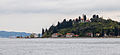
 Vista de Kotor y la bahía
 -
 Perast
 -
 Risan
Risan -
 Kostanjica
 -
 Lepetane
 -
 Ljuta
Ljuta


Referencias
[editar]- ↑ Monstat: Podaci na nivou naselja Archivado el 20 de octubre de 2018 en Wayback Machine.
Enlaces externos
[editar] Wikimedia Commons alberga una galería multimedia sobre Municipio de Kotor.
- Página de Kotor en la UNESCO (inglés)
 Datos: Q4856305
Text is available under the CC BY-SA 4.0 license; additional terms may apply.
Images, videos and audio are available under their respective licenses.
