Lukoyánov
| Lukoyánov Лукоя́нов | ||
|---|---|---|
| Entidad subnacional | ||
 Vista de Lukoyánov
| ||
 Escudo | ||
|
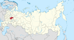
Localización de Lukoyánov en Óblast de Nizhni Nóvgorod | ||
|
Localización de Lukoyánov en Rusia europea | ||
 Ubicación del óblast de Nizhni Nóvgorod en Rusia | ||
| Coordenadas | 55°02′18″N 44°29′52″E / 55.038333333333, 44.497777777778 | |
| Entidad | Ciudad/pueblo | |
| • País |
| |
| Eventos históricos | ||
| • Fundación | siglo XVI | |
| Superficie | ||
| • Total | 6 km² | |
| Altitud | ||
| • Media | 180 m s. n. m. | |
| Población (2009) | ||
| • Total | 12,360 hab. | |
| • Densidad | 2,060 hab./km² | |
| Huso horario | UTC+03:00 | |
| Código postal | 607800 | |
| Prefijo telefónico | 83196 | |
| Sitio web oficial | ||
Lukoyánov (en ruso: Лукоянов) es una ciudad del óblast de Nizhni Nóvgorod, en Rusia, centro administrativo del raión homónimo. Está situada a orillas del río Tiosha, afluente del Oká, a 173 km al sur de Nizhni Nóvgorod. Su población alcanzaba los 12.360 habitantes en 2009.
Historia
[editar]Lukoyánov fue fundada en el siglo XVI, por un tal Ivashka Lukoyánov, que construyó aquí un molino y del cual la ciudad tomaría nombre. Desde el siglo XVII la ciudad pertenecía a la corte del zar. Tiene estatus de ciudad desde 1779, año en que se convirtió en el centro administrativo de un uyezd. En 1816, la ciudad fue gravemente dañada por un incendio.
Demografía
[editar]| 1897 | 1939 | 1959 | 1970 | 1979 | 1989 | 2002 | 2007 |
|---|---|---|---|---|---|---|---|
| 2 100 | 5 500 | 7 000 | 10 200 | 11 400 | 12 276 | 12 856 | 12 500 |
Cultura y lugares de interés
[editar]La ciudad cuenta con un mueseo en la casa familiar de madera de la familia Bolshin, del siglo XIX.
Industria e infraestructura
[editar]En Lukoyánov se encuentran compañías dedicadas al sector de la ingeniería mecánica, la industria de la construcción y de materiales para la misma (como materiales resistentes al fuego, etc.).
La ciudad está conectada a la línea ferroviaria construida en 1903 entre Ruzáyevka-Arzamás-Nizhni Nóvgorod. En cuanto al transporte por carretera, la ciudad está en la carretera R15 que une nizhni Nóvgorod-Arzamás-Saransk.
Personalidades
[editar]- Nikolái Urvantsev (1883-1985), geólogo y explorador.
Enlaces externos y referencias
[editar]- Sitio web del raión y el ayuntamiento (en ruso)
- Sitio web no oficial de la ciudad (en ruso)
- Informaciones sobre Lukoyánov (en ruso)
Text is available under the CC BY-SA 4.0 license; additional terms may apply.
Images, videos and audio are available under their respective licenses.


