Donges
| Donges | ||
|---|---|---|
| Entidad subnacional | ||
 | ||
 Escudo | ||
|
Localización de Donges en Francia | ||
 | ||
| Coordenadas | 47°19′23″N 2°04′34″O / 47.323055555556, -2.0761111111111 | |
| Entidad | Comuna de Francia | |
| • País |
| |
| • Región | Países del Loira | |
| • Departamento | Loira Atlántico | |
| • Distrito | distrito de Saint-Nazaire | |
| • Cantón | cantón de Montoir-de-Bretagne | |
| • Mancomunidad | Communauté d'agglomération de la région nazairienne et de l'estuaire[1] | |
| Alcalde |
Annette Auffret[1] (2008-2014) | |
| Superficie | ||
| • Total | 59.90 km² | |
| Altitud | ||
| • Media | 11 m s. n. m. | |
| • Máxima | 31[2] m s. n. m. | |
| • Mínima | 0[2] m s. n. m. | |
| Población (2007[3]) | ||
| • Total | 6467 hab. | |
| • Densidad | 167,28 hab./km² | |
| Gentilicio | Dongeois, Dongeoises (en francés)[1] | |
| Huso horario | CET (UTC +1) | |
| • en verano | CEST (UTC +2) | |
| Código postal | 44480[5] | |
| Código INSEE | 44052[6] | |
| Sitio web oficial | ||
 | ||
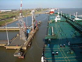
Donges es una población y comuna francesa, situada en la región de Países del Loira, departamento de Loira Atlántico, en el distrito de Saint-Nazaire y cantón de Montoir-de-Bretagne.
Demografía
[editar]Referencias
[editar]- ↑ a b c Communauté d'agglomération de la région nazairienne et de l'estuaire (ed.). «CARENE». Consultado el 10 de septiembre de 2010.
- ↑ a b EHESS (ed.). «Donges - Notice Communale». Consultado el 10 de septiembre de 2010.
- ↑ INSEE (ed.). «Populations légales en vigueur à compter du 1er janvier 2010». Consultado el 10 de septiembre de 2010.
- ↑ La Poste SNA (ed.). «La Poste». Archivado desde el original el 21 de mayo de 2011. Consultado el 10 de septiembre de 2010.
- ↑ Worldpostalcodes.org, código postal n.º 44480.
- ↑ INSEE, Datos de población para el año 2012 de Donges (en francés).
Enlaces externos
[editar] Wikimedia Commons alberga una categoría multimedia sobre Donges.
- INSEE
Text is available under the CC BY-SA 4.0 license; additional terms may apply.
Images, videos and audio are available under their respective licenses.

