Archivo:Map indicating McClure Strait, Northwest Territories, Canada.png
Map_indicating_McClure_Strait,_Northwest_Territories,_Canada.png (420 × 380 píxeles; tamaño de archivo: 59 kB; tipo MIME: image/png)
Resumen
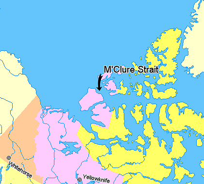
Map indicating McClure Strait (M'Clure Strait), Northwest Territories, Canada.
© Her Majesty the Queen in Right of Canada, Department of Natural Resources. All rights reserved.
Licence Agreement
Licencia

|
El poseedor de los derechos de autor de esta obra permite a cualquiera a usarla bajo cualquier propósito incluyendo sin restricciones su redistribución, uso comercial y modificación.
Notas de uso:
|
Historial del archivo
Haz clic sobre una fecha y hora para ver el archivo tal como apareció en ese momento.
| Fecha y hora | Miniatura | Dimensiones | Usuario | Comentario | |
|---|---|---|---|---|---|
| actual | 23:16 20 mar 2006 | | 420 × 380 (59 kB) | David Kernow~commonswiki | Map indicating Banks Island, Northwest Territories, Canada. ((legend|#ffff66|Nunavut)) ((legend|#ffccff|Northwest Territories)) ((legend|#ffcc99|Yukon Territory)) ((legend|#ffffcc|Regions outside Canada (Alaska, Greenland))) <br> © He |
Usos del archivo
La siguiente página usa este archivo:
Uso global del archivo
Las wikis siguientes utilizan este archivo:
- Uso en az.wikipedia.org
- Uso en be.wikipedia.org
- Uso en bn.wikipedia.org
- Uso en ca.wikipedia.org
- Uso en da.wikipedia.org
- Uso en de.wikipedia.org
- Uso en en.wikipedia.org
- Uso en fi.wikipedia.org
- Uso en fr.wikipedia.org
- Uso en he.wikipedia.org
- Uso en ja.wikipedia.org
- Uso en ka.wikipedia.org
- Uso en lt.wikipedia.org
- Uso en ml.wikipedia.org
- Uso en ne.wikipedia.org
- Uso en new.wikipedia.org
- Uso en nl.wikipedia.org
- Uso en nn.wikipedia.org
- Uso en pl.wikipedia.org
- Uso en pt.wikipedia.org
- Uso en sv.wikipedia.org
- Uso en tr.wikipedia.org
- Uso en zh.wikipedia.org
Text is available under the CC BY-SA 4.0 license; additional terms may apply.
Images, videos and audio are available under their respective licenses.
