Aeropuerto de Maripasoula
| Aeropuerto de Maripasoula | |||||
|---|---|---|---|---|---|
| Aérodrome de Maripasoula | |||||
 | |||||
| Localización | |||||
| Ubicación |
| ||||
| Elevación | 114,9 m | ||||
| Sirve a |
Maripasoula, | ||||
| Detalles del aeropuerto | |||||
| Propietario |
| ||||
| Estadísticas | |||||
| Estadísticas2 | ... etc. | ||||
| Mapa | |||||
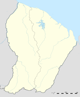
El Aeropuerto de Maripasoula[1] o bien Aeródromo de Maripasoula (en francés: Aérodrome de Maripasoula)[2] (IATA: MPY, ICAO: SOOA) es un aeropuerto situado a 3,5 kilómetros (1,9 millas náuticas) al norte de Maripasoula , un municipio en el distrito de Saint-Laurent-du-Maroni , en la Guayana Francesa[3] un territorio dependiente de Francia en América del Sur. Está cerca del río Lawa , que forma la frontera entre Francia y Surinam. Air Guyane Express operó vuelos regulares en el aeropuerto hasta agosto de 2023.[4]
El aeropuerto fue construido a una altitud de 115 m (377 pies) sobre el nivel medio del mar. Se ha designado una pista como 07/25 con una superficie de concreto que mide 1.200 por 15 metros (3.937 pies x 49 pies).
Véase también
[editar]Referencias
[editar]- ↑ «Información sobre el sitio» (en francés). Archivado desde el original el 16 de julio de 2014. Consultado el 26 de noviembre de 2015.
- ↑ Guyane 2014 Petit Futé (avec cartes, photos + avis des lecteurs) (en francés). Petit Futé. 29 de noviembre de 2013. ISBN 9782746976306. Consultado el 26 de noviembre de 2015.
- ↑ Guyane-Escapade au Surinam 2012-13 (en francés). Petit Futé. 15 de diciembre de 2011. ISBN 2746956373. Consultado el 26 de noviembre de 2015.
- ↑ «La Guyane privée d’avions : « L’enclavement tue toute perspective d’avenir »». La Croix (en fr-FR). 28 de octubre de 2023. ISSN 0242-6056. Consultado el 2 de mayo de 2024.
Text is available under the CC BY-SA 4.0 license; additional terms may apply.
Images, videos and audio are available under their respective licenses.

