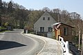
Trpišovice
| Trpišovice | |||
| germane Terpischowitz | |||
| municipo | |||
 Trpišovice
| |||
|
|||
| Oficiala nomo: Trpišovice | |||
| Ŝtato | |||
|---|---|---|---|
| Regiono | Regiono Vysočina | ||
| Distrikto | Distrikto Havlíčkův Brod | ||
| Administra municipo | Světlá nad Sázavou | ||
| Historia regiono | Bohemio | ||
| Montaro | Montetaro Křemešník | ||
| Rivero | Sázava | ||
| Situo | Trpišovice | ||
| - alteco | 475 m s. m. | ||
| - koordinatoj | 49° 39′ 19″ N 15° 19′ 56″ O / 49.65528 °N, 15.33222 °O (mapo) | ||
| Areo | 7,00 km² (700 ha) | ||
| Loĝantaro | 161 (2024) | ||
| Denseco | 23 loĝ./km² | ||
| Unua skribmencio | 1453 | ||
| Horzono | MET (UTC+1) | ||
| - somera tempo | MET (UTC+2) | ||
| Poŝtkodo | 582 91, 584 01 | ||
| NUTS 3 | CZ063 | ||
| NUTS 4 | CZ0631 | ||
| NUTS 5 | CZ0631 569623 | ||
| Katastraj teritorioj | 3 | ||
| Partoj de municipo | 6 | ||
| Bazaj setlejunuoj | 4 | ||
  Situo enkadre de Ĉeĥio
| |||
| Retpaĝo: www.trpisovice.cz | |||


Trpišovice (germane Terpischowitz) estas municipo en Ĉeĥio, regiono Vysočina, en distrikto Havlíčkův Brod. Vivas ĉi tie 161 loĝantoj (2024). La sidejo de la municipo ne troviĝas en Trpišovice, sed en Koňkovice.
La najbaraj municipoj de la setlejo estas Kouty, Vilémovice (distrikto Havlíčkův Brod), Světlá nad Sázavou, Bojiště kaj Dolní Město.
Historio
[redakti | redakti fonton]La unua skribmencio pri la municipo devenas el la jaro 1453.
Loĝantaro
[redakti | redakti fonton]Evoluo de nombro de loĝantoj
La datoj devenas el datumbazo de Vikidatumoj
| Jaro | Loĝantoj |
|---|---|
| 1869 | 467 |
| 1880 | 499 |
| 1890 | 480 |
| 1900 | 499 |
| 1910 | 476 |
| 1921 | 421 |
| Jaro | Loĝantoj |
|---|---|
| 1930 | 432 |
| 1950 | 335 |
| 1961 | 344 |
| 1970 | 328 |
| 1980 | 223 |
| 1991 | 171 |
| Jaro | Loĝantoj |
|---|---|
| 2001 | 158 |
| 2014 | 152 |
| 2016 | 153 |
| 2017 | 169 |
| 2018 | 171 |
| 2019 | 175 |
| Jaro | Loĝantoj |
|---|---|
| 2020 | 176 |
| 2021 | 166 |
| 2022 | 177 |
| 2023 | 166 |
| 2024 | 161 |
Partoj de municipo
[redakti | redakti fonton]- Trpišovice
- Bilantova Lhota
- Dobrovítova Lhota
- Koňkovice
- Remuta
- Smrčná
Naturrilatoj
[redakti | redakti fonton]Laŭlonge laŭ rivero Sázava tiriĝas naturrezervejo Stvořidla.
Pluaj fotoj
[redakti | redakti fonton]-
 Trpišovice
 -
 Trpišovice
 -
 Trpišovice
 -
 Stvořidla
.JPG)
.JPG)
.jpg)
.jpg)
| ||||
Text is available under the CC BY-SA 4.0 license; additional terms may apply.
Images, videos and audio are available under their respective licenses.
Cover photo is available under {{::mainImage.info.license.name || 'Unknown'}} license.
Cover photo is available under {{::mainImage.info.license.name || 'Unknown'}} license.
Credit:
(see original file).
