Semtěš
- Tiu ĉi artikolo temas pri municipo en distrikto Kutná Hora. Pri parto de municipo Pšov temas artikolo Semtěš (Pšov).
| Semtěš | |||
| germane Semtiesch | |||
| municipo | |||
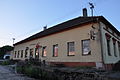
 Prisma turo de burgejo
| |||
|
|||
| Oficiala nomo: Semtěš | |||
| Ŝtato | |||
|---|---|---|---|
| Regiono | Mezbohemia regiono | ||
| Distrikto | Distrikto Kutná Hora | ||
| Administra municipo | Čáslav | ||
| Historia regiono | Bohemio | ||
| Montaro | Fera montaro | ||
| Situo | Semtěš | ||
| - alteco | 369 m s. m. | ||
| - koordinatoj | 49° 57′ 36″ N 15° 30′ 52″ O / 49.96000 °N, 15.51444 °O (mapo) | ||
| Katastro | 5,01 km² (501 ha) Semtěš u Bílého Podolí | ||
| Loĝantaro | 260 (2024) | ||
| Denseco | 51,9 loĝ./km² | ||
| Tabulo | Mezelba tabulo | ||
| Unua skribmencio | 1322 | ||
| Horzono | MET (UTC+1) | ||
| - somera tempo | MET (UTC+2) | ||
| Poŝtkodo | 286 01 | ||
| NUTS 3 | CZ020 | ||
| NUTS 4 | CZ0205 | ||
| NUTS 5 | CZ0205 530859 | ||
| Katastraj teritorioj | 1 | ||
| Partoj de municipo | 1 | ||
| Bazaj setlejunuoj | 1 | ||
  Situo enkadre de Ĉeĥio
| |||
| Retpaĝo: www.semtes.cz | |||


Semtěš (germane Semtiesch) estas municipo en Ĉeĥio situanta en distrikto Kutná Hora. Vivas ĉi tie 260 loĝantoj (2024). En distanco 9 km nordoriente situas urbo Přelouč, 10 km sudokcidente urbo Čáslav, 17 km okcidente urbo Kutná Hora kaj 20 km oriente urbo Chrudim.
La najbaraj municipoj de la setlejo estas Starkoč, Sovolusky, Turkovice, Podhořany u Ronova, Litošice kaj Bílé Podolí.
Historio
[redakti | redakti fonton]La unua skribmencio pri la vilaĝo estas el la jaro 1322.
Loĝantaro
[redakti | redakti fonton]Evoluo de nombro de loĝantoj
La datoj devenas el datumbazo de Vikidatumoj
| Jaro | Loĝantoj |
|---|---|
| 1869 | 627 |
| 1880 | 668 |
| 1890 | 671 |
| 1900 | 648 |
| 1910 | 607 |
| 1921 | 608 |
| Jaro | Loĝantoj |
|---|---|
| 1930 | 517 |
| 1950 | 417 |
| 1961 | 405 |
| 1970 | 364 |
| 1980 | 331 |
| 1991 | 290 |
| Jaro | Loĝantoj |
|---|---|
| 2001 | 278 |
| 2011 | 249 |
| 2014 | 284 |
| 2016 | 279 |
| 2017 | 270 |
| 2018 | 265 |
| Jaro | Loĝantoj |
|---|---|
| 2019 | 265 |
| 2020 | 272 |
| 2021 | 276 |
| 2022 | 269 |
| 2023 | 260 |
| 2024 | 260 |
Memorindaĵoj
[redakti | redakti fonton]- Burgejo Semtěš, kies restaĵo estas gotika turo, alta 22 m, eluzata kiel belvedero
- Super la orienta rando de la vilaĝo en la katastra teritorio de la najbara Sovolusky konserviĝis terenaj restaĵoj de burgo el la 13-a jarcento nomata Hradiště nad Semtěší.
- Evangelia preĝejo el la jaroj 1860–1863
Pluaj fotoj
[redakti | redakti fonton]-
 Vido el la turo de burgejo al preĝejo
 -
 Evangelia paroĥestrejo
 -
 Ĉambrego de Pelíšek
 -
 Gastejo


Text is available under the CC BY-SA 4.0 license; additional terms may apply.
Images, videos and audio are available under their respective licenses.
Cover photo is available under {{::mainImage.info.license.name || 'Unknown'}} license.
Cover photo is available under {{::mainImage.info.license.name || 'Unknown'}} license.
Credit:
(see original file).
