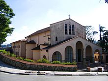
Ribeirão Pires
| Ribeirão Pires | |||
|---|---|---|---|
 | |||
| municipo de Brazilo urbego | |||
| Flago | Blazono | ||
| Administrado | |||
| Lando | |||
| Regiono | Sudorienta regiono | ||
| Subŝtato | |||
| Mezoregiono | Metropolitana de São Paulo | ||
| Mikroregiono | São Paulo | ||
| Fondita | 19-a de marto 1953 | ||
| Telefonkodo | 11 | ||
| En TTT | Oficiala retejo [+] | ||
| Demografio | |||
| Loĝantaro | 115 559 (2022) [+] | ||
| Loĝdenso | 1 165 loĝ./km² | ||
| Geografio | |||
| Geografia situo | 23° 43′ S, 46° 25′ U (mapo)-23.710833333333-46.412777777778Koordinatoj: 23° 43′ S, 46° 25′ U (mapo) [+] | ||
| Alto | 800 m | ||
| Areo | 99,18 km² | ||
| Horzono | UTC-03:00 | ||

| |||
| |||
| Alia projekto | |||
Ribeirão Pires estas municipo kaj urbego de la brazila subŝtato San-Paŭlio.
Geografio
[redakti | redakti fonton]

Ribeirão Pires situas en altebenaĵo en sudorienta parto de la lando inter San-Paŭlo (urbo) kaj la oceano. La najbaraj municipoj estas Ferraz de Vasconcelos (norde), Suzano oriente), Rio Grande da Serra (sude), Santo André (São Paulo) (sudokcidente) kaj Mauá (nordokcidente). La menciita San-Paŭlo troviĝas 29, Guarulhos 30, Campinas 114, Nova Iguaçu 322, Rio-de-Ĵanejro 338, Curitiba 343, Belo Horizonte 494, Goiânia 839, Porto Alegre 848. Braziljo 896, Campo Grande 920, Salvador de Bahio 1455, Maceió 1932, Teresina 2108, Recife 2131, Natalo (Brazilo) 2327, São Luís 2369, Belém 2487, Manaus 2719 km.
Historio
[redakti | redakti fonton]La unua mencio pri Ribeirão Pires okazis en la 18-a jarcento. En 1716 alvenis familio de Antonio Pires de Ávila, kiu donis nomon al la regiono. Kiam la fervojo estis konstruita en 1867, ekzistis neniuj haltoj en la regiono, nur en 1885 estis inaŭgurita la Ribeirão Pires stacio. Depost 1888 komencis alveni la unuaj italaj enmigrintoj. En la jaro 1895 estis konstruita la aktuala stacidomo, kiu malfermiĝis en 1900. Ribeirao Pires iĝis municipo en 1953.
Klimato
[redakti | redakti fonton]Ribeirão Pires situas en subtropika klimato. La averaĝa jara temperaturo estas 18 °C, la plej malvarma monato estas julio (15 °C) kaj la plej varma estas februaro (22 °C). Jare pluvas ĉirkaŭ 1,400 mm.
Referencoj
[redakti | redakti fonton]Vidu ankaŭ
[redakti | redakti fonton]Eksteraj ligiloj
[redakti | redakti fonton]Text is available under the CC BY-SA 4.0 license; additional terms may apply.
Images, videos and audio are available under their respective licenses.


