Monda heredaĵo Supra Mezrejna Valo


La monda heredaĵo Supra Mezrejna valo estas la kultura pejzaĝo ĉe la meza Rejno, kiu akceptiĝis je la 27a de junio 2002 kiel UNESKO-monda heredaĵo de UNESKO.[1] La mondheredaĵa regiono etendiĝas de Bingen/Rüdesheim ĝis Koblenco sur longeco de 67 km laŭlonge de la valo de la Rejno tra la Rejnlanda Ardeza Montaro.
Bildaro
[redakti | redakti fonton]-
Koblenz, la norda pordego al la monda heredaĵo kun la fortikaĵo Ehrenbreitstein
-
la Deutsches Eck ĉe la enfluejo de la Mozelo en la Rejnon
-
Kastelo Stolzenfels apud Koblenz, ekzemplo de la Rejna romantikismo
-
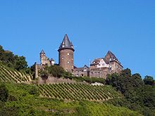
Marksburg apud Braubach, la sola ne detruita altaĵburgo en la mezrejna valo
-
rigardo de la maldekstra rejnbordo apud St. Goar al la Loreley, antaŭe ĉe la Rejno la ŝipo Goethe

-
Burgo Pfalzgrafenstein kaj Burgo Gutenfels (fone) apud Kaub
-
la ruino de la Werner-kapelo apud Bacharach
-
Burgo Rheinstein, la unua en la 19a jarcento rekonstruita burgo en la Mezrejna valo
-
Binger Loch estas la suda pordego en la monda heredaĵo, maldekstre Binger Mäuseturm, dekstre la Burgo Ehrenfels
-
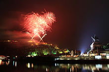
Niederwalddenkmal (Niederwald-monumento) Germania apud Rüdesheim

Kulturmonumentoj
[redakti | redakti fonton]


Vitikulturo
[redakti | redakti fonton]

Bergbau
[redakti | redakti fonton]


Vidu ankaŭ
[redakti | redakti fonton]- listo de burgoj, fortikaĵoj kaj kasteloj en Rejnlando-Palatinato
- listo de burgoj kaj kasteloj en Heslando
Literaturo
[redakti | redakti fonton]- Christian Schüler-Beigang (Hrsg.): Das Rheintal von Bingen und Rüdesheim bis Koblenz – Eine europäische Kulturlandschaft. Das zentrale Werk (Dokumentation zum UNESCO-Antrag). von Zabern, Mainz 2002, ISBN 3-8053-2753-6
- Erdmann Gormsen: Das Mittelrheintal – Eine Kulturlandschaft im Wandel. Leinpfad, Ingelheim 2003, ISBN 3-9808383-2-3
- Marcel Dombrowsky: Neue touristische Angebote im oberen Mittelrheintal - Einfluss der neuen touristischen Angebote auf den regionalökonomischen Aufschwung. AVM, München 2011, ISBN 978-3-86924-014-5
- UNESCO-Welterbe Oberes Mittelrheintal. Topographische Freizeitkarte 1 : 25000. Gemeinschaftlich hrsg. vom Landesamt für Vermessung und Geobasisinformation Rheinland-Pfalz und dem Hessischen Landesamt für Bodenmanagement und Geoinformation. 2. Auflage. Landesamt für Vermessung und Geobasisinformation Rheinland-Pfalz, Koblenz 2005, ISBN 3-89637-363-3, ISBN 3-89637-364-1, ISBN 3-89637-365-X (Set aus drei Karten: Koblenz – Loreley – Rüdesheim/ Bingen)
Eksteraj ligiloj
[redakti | redakti fonton]- Oficiala retejo de Landes Rheinland-Pfalz zum Welterbe Kulturlandschaft Oberes Mittelrheintal
- Oficiala retejo de Zweckverbands
- Karte des Welterbegebiets Arkivigite je 2017-09-18 per la retarkivo Wayback Machine (PDF; 6,82 MB)
- Antrag zur Aufnahme der Kulturlandschaft Oberes Mittelrheintal in die Welterbeliste der UNESCO (PDF; 251 kB)
Referencoj
[redakti | redakti fonton]- ↑ Mittelrheintal gehört zum Weltkulturerbe in: Rhein-Zeitung, 27a de Junio 2002
Text is available under the CC BY-SA 4.0 license; additional terms may apply.
Images, videos and audio are available under their respective licenses.


