Leicestershire

| Leicestershire | |||
|---|---|---|---|
| Graflando | |||
 | |||
 |  | ||
| Flago | Blazono | ||
| ceremonia kantono de Anglio [+] | |||
| Lando | Anglio | ||
| Koordinatoj | 53° N, 1° U (mapo)52.716666666667-1.1833333333333Koordinatoj: 53° N, 1° U (mapo) | ||
| Ĉefurbo | Leicester | ||
| - koordinatoj | 53° N, 1° U (mapo)52.716666666667-1.1833333333333Koordinatoj: 53° N, 1° U (mapo) [+] | ||
| Akvokolektejo | 2 156,23 km² (215 623 ha) [+] | ||
| Areo | 2 156,23 km² (215 623 ha) [+] | ||
| Loĝantaro | 1 067 121 [+] (2020) | ||
| ISO 3166-2 | GB-LEC | ||
|
|||
 |
|||
| Leicestershire | |||
| En TTT: Oficiala retejo [+] | |||

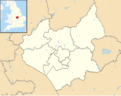
Leicestershire estas unu el la graflandoj de Anglio. Ĝi situas en la regiono East Midlands. La ĉefurbo estas Leicester - (la urbo ankaŭ estas unuara instanco).
Loĝantaro - 936 000
Areo - 2553 km²
Industrio - agrikulturo, karbominado, inĝenierado, ŝtrumpaĵoj, ŝuoj.
Urboj kaj vilaĝoj
[redakti | redakti fonton]- Anstey, Arnesby, Ashby-de-la-Zouch, Ashby Magna, Aston Flamville
- Birstall, Bottesford, Breedon on the Hill, Burbage, Bushby
- Cadeby, Castle Donington, Coalville, Countesthorpe, Croft
- Donisthorpe
- Earl Shilton, East Norton, Edith Weston
- Gaddesby
- Hallaton, Hinckley, Horninghold, Husbands Bosworth
- Kegworth, Kirby Muxloe
- Little Dalby, Loughborough, Lutterworth
- Market Harborough, Measham, Melton Mowbray, Moira, Mountsorrel
- Newton Harcourt, Newtown Linford, Normanton
- Oadby
- Peatling Parva
- Queniborough, Quorndon
- Rothley
- Shackerstone, Shearsby, Sheepy Magna, Sheepy Parva, Shepshed, Stoney Stanton, Sutton Cheney, Swinford, Syston
- Thurmaston, Thurnby, Twycross
- Walcote, Walton, Wigston, Woodhouse Eaves
Vizitindaĵoj
[redakti | redakti fonton]- Launde Abbey
- Leicester Botanic Gardens – botanika ĝardeno
- Bradgate House
- Belvoir Castle
- Bosworth Battlefield
- The Battlefield Line, fervojo
- The National Forest
- Moira Furnace

Eksteraj ligiloj
[redakti | redakti fonton]
| ||||||
Text is available under the CC BY-SA 4.0 license; additional terms may apply.
Images, videos and audio are available under their respective licenses.


