Dosiero:Essonne department relief location map.jpg
Grandeco de ĉi antaŭvido: 578 × 600 rastrumeroj. Aliaj distingivoj: 231 × 240 rastrumeroj | 463 × 480 rastrumeroj | 982 × 1 019 rastrumeroj.
Bildo en pli alta difino ((982 × 1 019 rastrumeroj, grandeco de dosiero: 259 KB, MIME-tipo: image/jpeg))
| Jen dosiero de la Wikimedia-Komunejo. La priskribo en ties priskriba paĝo estas montrata suben.
|
Resumo
| Pozicio de la fotilo | | Tiu cxi bildo kaj pliaj sur OpenStreetMap |
|---|
| Priskribo |
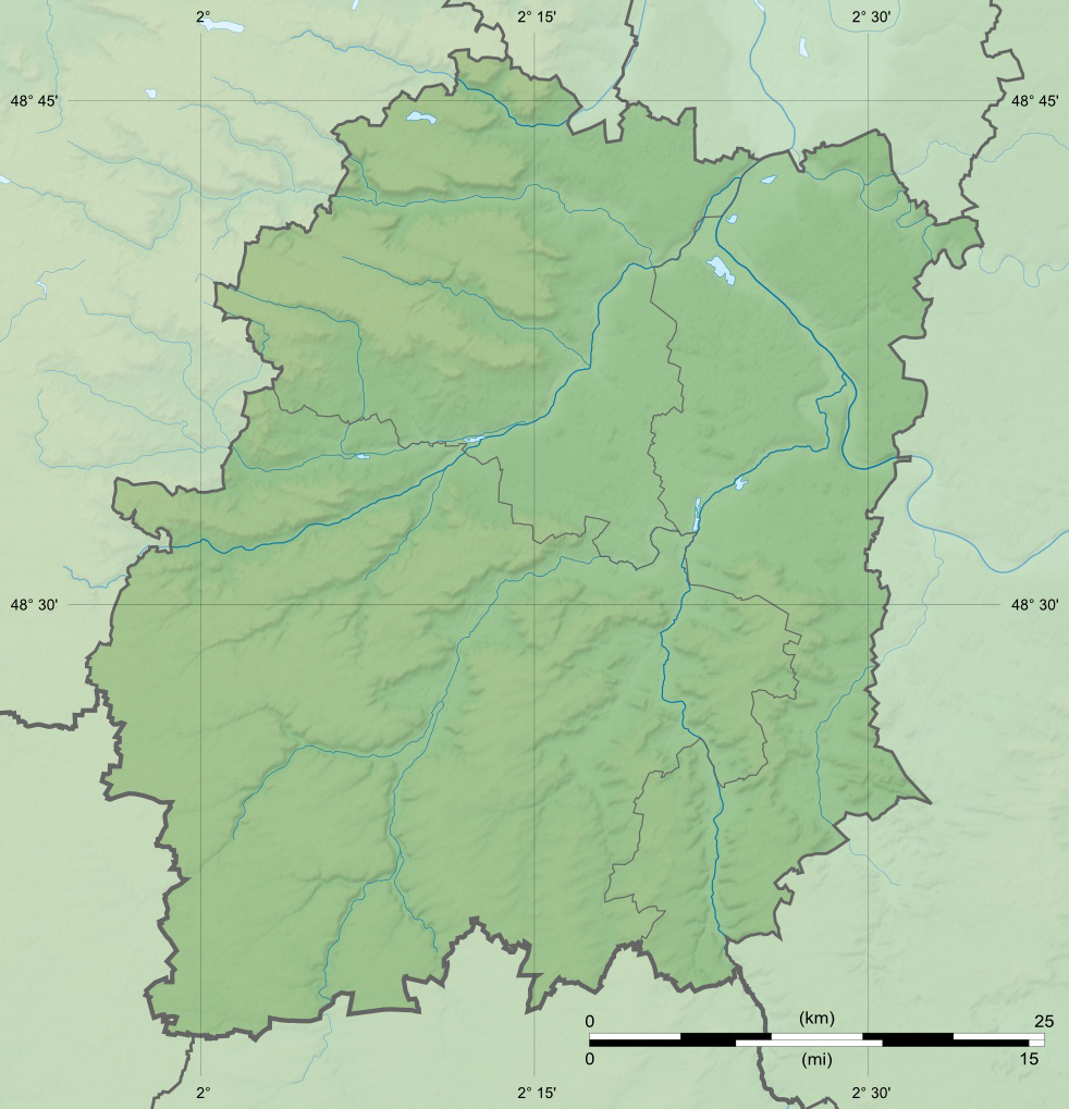
English: Blank physical map of the department of Essonne, France, for geo-location purpose, with distinct boundaries for regions, departments and arrondissements.
Français : Carte physique vierge du département de l'Essonne, France, destinée à la géolocalisation, avec limite distincte des régions, départements et arrondissements. Scales: 1:372,000 (precision: 93 m) for the topography;
Geographic limits of the map:
|
||
| Dato | |||
| Fonto |
Propra verko
|
||
| Aŭtoro | Eric Gaba (Sting - fr:Sting) | ||
| Permeso (Reuzo de la dosiero) |
|
||
| Ceteraj versioj |
|

Permesiloj:
Mi, la posedanto de la aŭtorrajto por ĉi tiu verko, ĉi-maniere publikigas ĝin laŭ la jenaj permesiloj:
Ĉi tiu dosiero estas disponebla laŭ la permesilo Krea Komunaĵo Atribuite-Samkondiĉe 3.0 Neadaptita.
- Vi rajtas:
- kunhavigi – kopii, distribui kaj publikigi la verkon
- aliigi – modifi, adapti, kompletigi, transformi, uzi la tutan verkon aŭ ties partojn, memstare aŭ en aliaj verkoj
- La verko rajtas esti kunhavigata nur:
- atribuite – Vi devas atribui aŭtorecon, liveri ligilon al la permesilo kaj marki ĉu ŝanĝoj estis faritaj. Faru tion en aprobinda maniero, tamen ne sugestante, ke permesinto aprobas vin aŭ vian uzon.
- samkondiĉe – Se vi rekombinas la verkon, transformas ĝin aŭ kreas devenaĵon bazitan sur ĝi, vi rajtas distribui la rezultan verkon nur laŭ la sama aŭ kongrua permesilo kompare kun ĉi tiu.

|
Estas permesite kopii, disdoni kaj/aŭ redakti ĉi tiun dokumenton, sen senŝanĝaj sekcioj, sen antaŭkovrilaj kaj sen dorskovrilaj tekstoj, laŭ la kondiĉoj de la Permesilo GNU por Liberaj Dokumentoj, Versio 1.2 aŭ ajna pli nova versio eldonita de la Free Software Foundation; sen Senŝanĝaj Sekcioj, Antaŭovrilaj Tekstoj aŭ Malantaŭkovrilaj Tekstoj. Kopio de la permesilo estas inkluzivita en la sekcio titolita GNU Free Documentation License. |
Vi povas elekti la permesilon preferatan.
Dosierhistorio
Alklaku iun daton kaj horon por vidi kiel la dosiero tiam aspektis.
| Dato/Horo | Bildeto | Grandecoj | Uzanto | Komento | |
|---|---|---|---|---|---|
| nun | 13:49, 18 jul. 2010 | | 982 × 1 019 (259 KB) | Sting | Color profile |
| 15:11, 13 aŭg. 2008 |  | 982 × 1 019 (234 KB) | Sting | == Summary == ((Location|48|31|30|N|02|15|00|E|scale:1000000)) <br/> ((Information |Description=((en|Blank physical map of the department of Essonne, France, for geo-location purpose, with distinct boundaries for regions, departments and a |
Dosiera uzado
Suma uzado de la dosiero
La jenaj aliaj vikioj utiligas ĉi tiun dosieron:
- Uzado en als.wikipedia.org
- Uzado en de.wikipedia.org
- Uzado en dsb.wikipedia.org
- Uzado en fr.wikipedia.org
- Essonne (département)
- Verrières-le-Buisson
- Athis-Mons
- Évry
- Breuillet (Essonne)
- Épinay-sur-Orge
- Arpajon
- Saint-Germain-lès-Arpajon
- Varennes-Jarcy
- Boutigny-sur-Essonne
- Forêt de Sénart
- Gif-sur-Yvette
- Bouray-sur-Juine
- Corbeil-Essonnes
- Bures-sur-Yvette
- Villebon-sur-Yvette
- Abbéville-la-Rivière
- Égly
- Palaiseau
- Gometz-le-Châtel
- Juvisy-sur-Orge
- Grigny (Essonne)
- Villiers-sur-Orge
- Boissy-sous-Saint-Yon
- Les Ulis
- Gometz-la-Ville
- Limours
- Bièvres (Essonne)
- Montlhéry
- Linas
- Saint-Jean-de-Beauregard
Vidi plian ĝeneralan uzadon de ĉi tiu dosiero.
Metadatumoj
Text is available under the CC BY-SA 4.0 license; additional terms may apply.
Images, videos and audio are available under their respective licenses.
Cover photo is available under {{::mainImage.info.license.name || 'Unknown'}} license.
Cover photo is available under {{::mainImage.info.license.name || 'Unknown'}} license.
Credit:
(see original file).
