Dosiero:Cape Colony map.png
Grandeco de ĉi antaŭvido: 725 × 600 rastrumeroj. Aliaj distingivoj: 290 × 240 rastrumeroj | 581 × 480 rastrumeroj | 1 000 × 827 rastrumeroj.
Bildo en pli alta difino ((1 000 × 827 rastrumeroj, grandeco de dosiero: 49 KB, MIME-tipo: image/png))
| Jen dosiero de la Wikimedia-Komunejo. La priskribo en ties priskriba paĝo estas montrata suben.
|

|
File:Map of the provinces of South Africa 1976-1994 with the Cape highlighted.svg estas vektora versio de ĉi tiu bildo. Ĝi estu uzata anstataŭ la rastruma bildo.
File:Cape Colony map.png → File:Map of the provinces of South Africa 1976-1994 with the Cape highlighted.svg
Pliajn informojn vidu ĉe Help:SVG. |
 |
Resumo
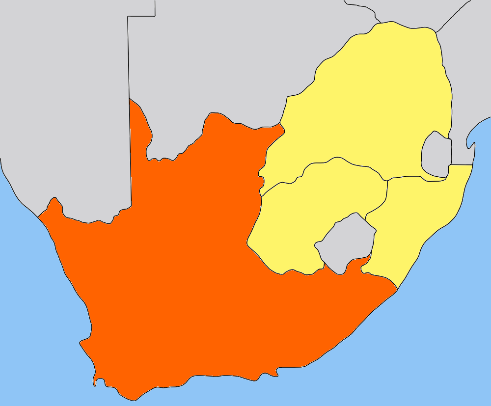
| Priskribo | Map of the Cape Colony/Cape Province in South Africa. Traced by hand in Inkscape from older version of this image, recoloured in the GIMP. |
| Dato | |
| Fonto | Own work, based on low-res map made by Messhermit and uploaded by Valentinian (see older versions of this file) |
| Aŭtoro | Self |
| Permeso (Reuzo de la dosiero) |
CC-BY-SA-2.5 |
| Ceteraj versioj | Other province maps based on the same work: Cape Colony, Transvaal, Natal Colony, Orange Free State |
Vidu ankaŭ   
|
Permesiloj:
Ĉi tiu dosiero estas disponebla laŭ la permesilo Krea Komunaĵo Atribuite-Samkondiĉe 2.5 Ĝenerala.
- Vi rajtas:
- kunhavigi – kopii, distribui kaj publikigi la verkon
- aliigi – modifi, adapti, kompletigi, transformi, uzi la tutan verkon aŭ ties partojn, memstare aŭ en aliaj verkoj
- La verko rajtas esti kunhavigata nur:
- atribuite – Vi devas atribui aŭtorecon, liveri ligilon al la permesilo kaj marki ĉu ŝanĝoj estis faritaj. Faru tion en aprobinda maniero, tamen ne sugestante, ke permesinto aprobas vin aŭ vian uzon.
- samkondiĉe – Se vi rekombinas la verkon, transformas ĝin aŭ kreas devenaĵon bazitan sur ĝi, vi rajtas distribui la rezultan verkon nur laŭ la sama aŭ kongrua permesilo kompare kun ĉi tiu.
Dosierhistorio
Alklaku iun daton kaj horon por vidi kiel la dosiero tiam aspektis.
| Dato/Horo | Bildeto | Grandecoj | Uzanto | Komento | |
|---|---|---|---|---|---|
| nun | 20:01, 9 maj. 2006 | | 1 000 × 827 (49 KB) | Dewet | ((Information| |Description=Map of the Cape Colony; traced by hand in Inkscape, recoloured in the GIMP. |Source=Own work |Date=2006-05-09 |Author=Self, based on [[:image:Cape_Colony_map.png|Cape Colony map |
| 15:05, 25 jul. 2005 |  | 305 × 252 (41 KB) | Valentinian | Map of the former Cape Colony in South Africa (before 1910.) ((PD-self)) Based on the map of Transvaal made by user:Messhermit |
Dosiera uzado
La jenaj paĝoj ligas al ĉi tiu dosiero:
Suma uzado de la dosiero
La jenaj aliaj vikioj utiligas ĉi tiun dosieron:
- Uzado en ar.wikipedia.org
- Uzado en be.wikipedia.org
- Uzado en bg.wikipedia.org
- Uzado en da.wikipedia.org
- Uzado en de.wikipedia.org
- Uzado en el.wikipedia.org
- Uzado en en.wikipedia.org
- Uzado en frr.wikipedia.org
- Uzado en fr.wikipedia.org
- Province du Cap
- Histoire de la colonie du Cap
- Wikipédia:Sélection/Afrique
- Wikipédia:Lumière sur/Histoire de la Colonie du Cap
- Portail:Monde colonial
- Wikipédia:Sélection/Colonisation
- Wikipédia:Sélection/Afrique/Par pays
- Wikipédia:Sélection/Afrique du Sud
- Portail:Le Cap
- Wikipédia:Sélection/Le Cap
- Wikipédia:Lumière sur/Août 2014
- Uzado en hu.wikipedia.org
- Uzado en it.wikipedia.org
- Uzado en ka.wikipedia.org
- Uzado en lt.wikipedia.org
- Uzado en nn.wikipedia.org
- Uzado en no.wikipedia.org
- Portal:Afrika/Utvalgt artikkel
- Kappkolonien
- Kapp-provinsen
- Portal:Afrika/Utvalgt artikkel/Arkiv
- Wikipedia:Ukens danske artikkel/2010
- Portal:Afrika/Utvalgt artikkel/juli
- Portal:Sør-Afrika
- Portal:Sør-Afrika/Utvalgt artikkel
- Portal:Sør-Afrika/Utvalgt artikkel/Arkiv
- Portal:Sør-Afrika/Utvalgt artikkel/juni
- Wikipedia:Ukens danske artikkel/Uke 29, 2010
- Uzado en pl.wikipedia.org
- Uzado en pt.wikipedia.org
- Uzado en ru.wikipedia.org
- Uzado en simple.wikipedia.org
- Uzado en sw.wikipedia.org
- Uzado en zh.wikipedia.org
Text is available under the CC BY-SA 4.0 license; additional terms may apply.
Images, videos and audio are available under their respective licenses.
Cover photo is available under {{::mainImage.info.license.name || 'Unknown'}} license.
Cover photo is available under {{::mainImage.info.license.name || 'Unknown'}} license.
Credit:
(see original file).
