Zirtang Rural District
Zirtang Rural District
Persian: دهستان زيرتنگ | |
|---|---|
| Coordinates: 33°25′45″N 47°04′59″E / 33.42917°N 47.08306°E[1] | |
| Country | Iran |
| Province | Lorestan |
| County | Kuhdasht |
| District | Kuhnani |
| Capital | Garkhashab |
| Population (2016)[2] | |
| • Total | 4,859 |
| Time zone | UTC+3:30 (IRST) |
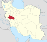
Zirtang Rural District (Persian: دهستان زيرتنگ)[a] is in Kuhnani District of Kuhdasht County, Lorestan province, Iran.[3] Its capital is the village of Garkhashab.[4]
Demographics
[edit]Population
[edit]At the time of the 2006 National Census, the rural district's population was 6,444 in 1,207 households.[5] There were 6,031 inhabitants in 1,376 households at the following census of 2011.[6] The 2016 census measured the population of the rural district as 4,859 in 1,315 households. The most populous of its 39 villages was Nam Kul, with 638 people.[2]
See also
[edit]Notes
[edit]- ^ Formerly Rumeshkan-e Gharbi Rural District (دهستان رومشكان غربي)
References
[edit]- ^ OpenStreetMap contributors (27 August 2023). "Zirtang Rural District (Kuhdasht County)" (Map). OpenStreetMap (in Persian). Retrieved 27 August 2023.
- ^ a b "Census of the Islamic Republic of Iran, 1395 (2016)". AMAR (in Persian). The Statistical Center of Iran. p. 15. Archived from the original (Excel) on 12 October 2020. Retrieved 19 December 2022.
- ^ Habibi, Hassan (6 October 2014). "Divisional reforms in Lorestan province". Islamic Parliament Research Center (in Persian). Archived from the original on 28 September 2015. Retrieved 28 August 2023.
- ^ Mousavi, Mirhossein. "Creation and formation of 47 rural districts including villages, farms and places in Khorramabad County under Lorestan province". Research Center of the System of Laws of the Islamic Council of Farabi Mobile Library (in Persian). Ministry of Interior, Council of Ministers. Archived from the original on 20 February 2013. Retrieved 28 November 2023.
- ^ "Census of the Islamic Republic of Iran, 1385 (2006)". AMAR (in Persian). The Statistical Center of Iran. p. 15. Archived from the original (Excel) on 20 September 2011. Retrieved 25 September 2022.
- ^ "Census of the Islamic Republic of Iran, 1390 (2011)". Syracuse University (in Persian). The Statistical Center of Iran. p. 15. Archived from the original (Excel) on 19 January 2023. Retrieved 19 December 2022.
Lorestan Province, Iran | |||||||||||||||||||||||
|---|---|---|---|---|---|---|---|---|---|---|---|---|---|---|---|---|---|---|---|---|---|---|---|
| Capital | |||||||||||||||||||||||
| Counties and cities |
| ||||||||||||||||||||||
| Sights |
| ||||||||||||||||||||||
| populated places | |||||||||||||||||||||||
Text is available under the CC BY-SA 4.0 license; additional terms may apply.
Images, videos and audio are available under their respective licenses.


