Woudenberg
Woudenberg | |
|---|---|
Town and municipality | |
 Woudenberg Town Hall | |
 Flag Coat of arms | |
.svg) Location in Utrecht | |
| Coordinates: 52°5′N 5°25′E / 52.083°N 5.417°E | |
| Country | Netherlands |
| Province | Utrecht |
| Government | |
| • Body | Municipal council |
| • Mayor | Titia Cnossen-Looijenga (CU) |
| Area | |
| • Total | 36.82 km2 (14.22 sq mi) |
| • Land | 36.53 km2 (14.10 sq mi) |
| • Water | 0.29 km2 (0.11 sq mi) |
| Elevation | 3 m (10 ft) |
| Population (January 2021)[4] | |
| • Total | 13,639 |
| • Density | 373/km2 (970/sq mi) |
| Time zone | UTC+1 (CET) |
| • Summer (DST) | UTC+2 (CEST) |
| Postcode | 3930–3931 |
| Area code | 033 |
| Website | www |
Woudenberg (Dutch pronunciation: [ˈʋʌudə(m)ˌbɛr(ə)x] ) is a town and municipality in the central Netherlands, in the province of Utrecht. In 2023, it had a population of 14,410.
There are forests in the western part of the municipality in which the Pyramid of Austerlitz is located. The municipality also borders the province of Gelderland to the east.
Etymology
[edit]The name Woudenberg refers to a forested hill; nowadays the town lies in an agricultural area about 8 km south of Amersfoort.
Topography
[edit]
Dutch Topographic map of the municipality of Woudenberg, 2013.
Economy
[edit]The main sources of income were the raising of livestock and the cultivation of tobacco. Currently, most people work out of town, mostly in the surrounding towns of Amersfoort, Utrecht and Veenendaal.
Tourism
[edit]Because of the many attractions nearby, such as the Grebbe, the Pyramid of Austerlitz and the Henschotermeer, Woudenberg is visited by many tourists. That can also be derived from the number of tourist accommodation, which is 12.
Notable people
[edit]- Arie de Vroet (1918 – 1999 in Woudenberg) footballer
- Erik Verlinde & Herman Verlinde (born 1962) identical twin brothers and theoretical physicists and string theorist
- Ricky van Wolfswinkel (born 1989) professional footballer
Gallery
[edit]-
 Town centre of Woudenberg looking towards the Raadhuis
 -

-
 Modern Woudenberg
 -
 Woudenberg panoramio
 -
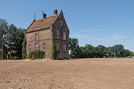 House near the station


References
[edit]- ^ "Samenstelling college" [Members of the board] (in Dutch). Gemeente Woudenberg. Retrieved 11 April 2014.
- ^ "Kerncijfers wijken en buurten 2020" [Key figures for neighbourhoods 2020]. StatLine (in Dutch). CBS. 24 July 2020. Retrieved 19 September 2020.
- ^ "Postcodetool for 3931KK". Actueel Hoogtebestand Nederland (in Dutch). Het Waterschapshuis. Retrieved 11 April 2014.
- ^ "Bevolkingsontwikkeling; regio per maand" [Population growth; regions per month]. CBS Statline (in Dutch). CBS. 1 January 2021. Retrieved 2 January 2022.
External links
[edit] Media related to Woudenberg at Wikimedia Commons
- Official website
Places adjacent to Woudenberg | ||||||||||||||||
|---|---|---|---|---|---|---|---|---|---|---|---|---|---|---|---|---|
| ||||||||||||||||
Municipalities of Utrecht | ||
|---|---|---|
 | ||
| ||
Text is available under the CC BY-SA 4.0 license; additional terms may apply.
Images, videos and audio are available under their respective licenses.
