Underbool
| Underbool Victoria | |||||||||||||||
|---|---|---|---|---|---|---|---|---|---|---|---|---|---|---|---|
 Mallee Highway at Underbool | |||||||||||||||
| Coordinates | 35°10′0″S 141°49′0″E / 35.16667°S 141.81667°E | ||||||||||||||
| Population | 216 (2016 census)[1] | ||||||||||||||
| Postcode(s) | 3509 | ||||||||||||||
| Elevation | 91 m (299 ft) | ||||||||||||||
| Location | |||||||||||||||
| LGA(s) | Rural City of Mildura | ||||||||||||||
| State electorate(s) | Mildura | ||||||||||||||
| Federal division(s) | Mallee | ||||||||||||||
| |||||||||||||||
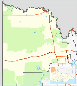
Underbool is a town in the Mallee region of north-west Victoria, Australia. The town is in the Rural City of Mildura local government area and on the Mallee Highway—between Ouyen and the South Australian border – 476 kilometres (296 mi) north west of the state capital, Melbourne. The town services the grain farmers and graziers in the area. For tourists it provides access to the Pink Lakes in Murray-Sunset National Park.
The town name is thought to come from the German word underbolt given to it by surveyor Dr. Neumayer when he camped there in October 1861.[citation needed]
A post office opened on 15 July 1912 when a regular mail service was provided by the opening of the railway from Ouyen to Murrayville a month earlier.[3]
Underbool Primary School (No. 3819) opened on 5 November 1913, with a purpose-built school building opening in June 1919. A second weatherboard building was built in 1929, and the former Daalko school building moved there in 1967.[4]
With its neighbouring township Walpeup Underbool had a football team (Walpeup-Underbool) in the Mallee Football League until the league folded in 2015. The team merged with Ouyen and play two matches a season in Underbool in the Sunraysia Football League. Golfers play at the course of the Underbool Golf Club on Monash Avenue.[5]
References
[edit]- ^ Australian Bureau of Statistics (27 June 2017). "Underbool (State Suburb)". 2016 Census QuickStats. Retrieved 1 September 2020.
- ^ Travelmate
- ^ Phoenix Auctions History, Post Office List, retrieved 9 February 2021
- ^ What Happened To All The Schools?. Local History Resource Centre. 1989. p. 72.
- ^ Golf Select, Underbool, retrieved 11 May 2009
External links
[edit]![]() Media related to Underbool, Victoria at Wikimedia Commons
Media related to Underbool, Victoria at Wikimedia Commons
Localities in the Rural City of Mildura | ||
|---|---|---|
| City | ||
| Town | ||
| Locality | ||
^ - Territory divided with another LGA | ||
Text is available under the CC BY-SA 4.0 license; additional terms may apply.
Images, videos and audio are available under their respective licenses.


