Tehrathum District
Tehrathum District
तेह्रथुम | |
|---|---|
 Landscape of Tehrathum | |
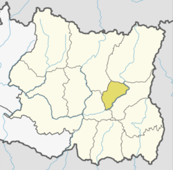
 District location of Tehrathum in Koshi Province | |
| Country | |
| Province | Koshi Province |
| Admin HQ. | Myanglung |
| Government | |
| • Type | Coordination committee |
| • Body | DCC, Tehrathum |
| Area | |
| • Total | 679 km2 (262 sq mi) |
| Population | |
| • Total | 88,731 |
| • Density | 130/km2 (340/sq mi) |
| Time zone | UTC+05:45 (NPT) |
| Telephone Code | 0092 |
| Website | ddctehrathum.gov.np |
Tehrathum District (Nepali: तेह्रथुम जिल्ला pronounced [teɾʌtʰum] ), is one of 14 districts of Koshi Province of Nepal.
Demographics
[edit]| Year | Pop. | ±% p.a. |
|---|---|---|
| 1981 | 92,454 | — |
| 1991 | 102,870 | +1.07% |
| 2001 | 113,111 | +0.95% |
| 2011 | 101,577 | −1.07% |
| 2022 | 88,731 | −1.22% |
| Sources:[1] | ||
In 2021, Terhathum district had a population of 88,731. Tehrathum had a literacy rate of 81.9% and a sex ratio of 1036 females per 1000 males. 34,079 (38.41%) lived in urban municipalities.[2]
Ethnicity/caste: 36.40% were Limbu, 19.41% Chhetri, 11.11% Hill Brahmin, 6.91% Tamang, 4.32% Kami, 3.44% Damai/Dholi, 3.26% Gurung, 2.84% Newar, 2.78% Magar, 1.80% Rai, 1.58% Sherpa, 1.50% Sarki and 1.36% Gharti/Bhujel.[3]
| Religion in Tehrathum District (2021)[4] | ||||
|---|---|---|---|---|
| Religion | Percent | |||
| Hinduism | 50.96% | |||
| Kirat Mundhum | 33.20% | |||
| Buddhism | 13.51% | |||
| Christianity | 2.08% | |||
| Others | 0.25% | |||
Religion: 50.96% were Hindu, 33.20% Kirati, 13.51% Buddhist, 2.08% Christian, and 0.25% others.[4]
As their first language in 2021, 50.64% of the population spoke Nepali, 33.96% Limbu, 6.26% Tamang, 2.50% Magar, 1.36% Gurung, 1.25% Sherpa and 1.06% Newar.[5] In 2011, 49.84% of the population spoke Nepali as their first language.[6]
Geographics
[edit]| Climate Zone[7] | Elevation Range | % of Area |
|---|---|---|
| Upper Tropical | 300 to 1,000 meters 1,000 to 3,300 ft. |
24.0% |
| Subtropical | 1,000 to 2,000 meters 3,300 to 6,600 ft. |
56.4% |
| Temperate | 2,000 to 3,000 meters 6,400 to 9,800 ft. |
19.5% |
Division
[edit]Tehrathum District consists of the following six subdivisions:[8]
| Local body | Nepali | Type | Population (2011) |
|---|---|---|---|
| Aathrai | आठराई | Rural municipality | 18,156 |
| Chhathar | छथर | Rural municipality | 14,197 |
| Laligurans | लालीगुराँस | Municipality | 15,329 |
| Menchhayayem | मेन्छयायेम | Rural municipality | 6,678 |
| Myanglung | म्याङलुङ | Municipality | 18,750 |
| Phedap | फेदाप | Rural municipality | 15,169 |
See also
[edit]References
[edit]- ^ "Nepal: Provinces and Districts". www.citypopulation.de.
- ^ "Provincial/District/Local reports: Koshi Province". Census Nepal 2021. Central Bureau of Statistics.
- ^ a b "Table 1: Caste/Ethnicity and sex". Census Nepal 2021. Central Bureau of Statistics. Retrieved 2024-03-16.
- ^ a b "Table 5: Religion and sex". Census Nepal 2021. Central Bureau of Statistics. Retrieved 2024-03-16.
- ^ "Table 5: Mother tongue and sex". Census Nepal 2021. Central Bureau of Statistics.
- ^ "Social characteristics tables" (PDF). Central Bureau of Statistics.
- ^ The Map of Potential Vegetation of Nepal - a forestry/agroecological/biodiversity classification system (PDF), Forest & Landscape Development and Environment Series 2-2005 and CFC-TIS Document Series No.110., 2005, ISBN 87-7903-210-9, retrieved Nov 22, 2013
- ^ "Nepal: Municipal Division (Districts and Local Units) - Population Statistics, Charts and Map". www.citypopulation.de. Retrieved 2023-03-28.
- "Districts of Nepal". Statoids.
External links
[edit]Places adjacent to Tehrathum District | ||||||||||||||||
|---|---|---|---|---|---|---|---|---|---|---|---|---|---|---|---|---|
| ||||||||||||||||
Headquarters: Myanglung Municipality | ||
| Rural municipalities | ||
| Municipalities | ||
| Koshi | ||
|---|---|---|
| Madhesh | ||
| Bagmati | ||
| Gandaki | ||
| Lumbini | ||
| Karnali | ||
| Sudurpashchim | ||
27°15′N 87°35′E / 27.250°N 87.583°E
Text is available under the CC BY-SA 4.0 license; additional terms may apply.
Images, videos and audio are available under their respective licenses.

