Tanah Grogot
Tanah Grogot | |
|---|---|
 Tanah Grogot district office | |
 Tanah Grogot  Tanah Grogot | |
| Coordinates: 01°54′08″S 116°11′21″E / 1.90222°S 116.18917°E | |
| Country | |
| Provinces | East Kalimantan |
| Regency | Paser |
| Villages | 16 |
| Government | |
| • Camat | HM Guntur[1] |
| Area | |
| • Total | 358.38 km2 (138.37 sq mi) |
| Elevation | 5 m (16 ft) |
| Population (2020) | |
| • Total | 76,344 |
| • Density | 210/km2 (550/sq mi) |
| Time zone | UTC+7 (WIB) |
| Postal code | 76251 |
| Ministry of Home Affairs Code | 64.01.04 |
Tanah Grogot is a district (kecamatan) and the capital of Paser Regency, East Kalimantan, Indonesia. It shares a border with Kuaro in the north, Pasir Belengkong in the south. In the year 2020, its total population is 76,344.[2]
On December 29, 1959, Tanah Grogot was inaugurated as the capital of Paser Regency by the law No. 27 of 1959.
Geography
[edit]Tanah Grogot is located on the southern part of Paser Regency, eastern side of Borneo. Its average elevation is 5 meters above the sea level.[3]
Climate
[edit]Tanah Grogot has a Tropical Rainforest Climate (Af). It gets the most amount of rainfall in March, with an average precipitation of 305 mm; and the least rainfall in August, with an average precipitation of 92 mm.
| Climate data for Tanah Grogot | |||||||||||||
|---|---|---|---|---|---|---|---|---|---|---|---|---|---|
| Month | Jan | Feb | Mar | Apr | May | Jun | Jul | Aug | Sep | Oct | Nov | Dec | Year |
| Mean daily maximum °C (°F) | 29.4 (84.9) |
29.5 (85.1) |
29.5 (85.1) |
29.5 (85.1) |
29.4 (84.9) |
28.9 (84.0) |
28.8 (83.8) |
29.5 (85.1) |
30.3 (86.5) |
30.5 (86.9) |
29.8 (85.6) |
29.5 (85.1) |
29.6 (85.2) |
| Daily mean °C (°F) | 25.8 (78.4) |
25.9 (78.6) |
25.9 (78.6) |
26.1 (79.0) |
26.2 (79.2) |
25.8 (78.4) |
25.6 (78.1) |
26 (79) |
26.5 (79.7) |
26.6 (79.9) |
26.2 (79.2) |
26 (79) |
26.1 (78.9) |
| Mean daily minimum °C (°F) | 23.6 (74.5) |
23.6 (74.5) |
23.7 (74.7) |
23.9 (75.0) |
24.1 (75.4) |
23.7 (74.7) |
23.4 (74.1) |
23.5 (74.3) |
23.7 (74.7) |
23.8 (74.8) |
23.8 (74.8) |
23.8 (74.8) |
23.7 (74.7) |
| Average rainfall mm (inches) | 280 (11.0) |
257 (10.1) |
305 (12.0) |
285 (11.2) |
213 (8.4) |
176 (6.9) |
138 (5.4) |
92 (3.6) |
102 (4.0) |
159 (6.3) |
229 (9.0) |
269 (10.6) |
2,505 (98.5) |
| Source: Climate-Data.org[4] | |||||||||||||
Administrative division
[edit]Tanah Grogot is divided into the following 15 villages and 1 subdistrict:[2]
| Name | Type | Area (km2) | Population (2020) |
|---|---|---|---|
| Janju | Village | 40.08 | 2,497 |
| Sempulang | Village | 8.20 | 1,826 |
| Tepian Batang | Village | 25.97 | 5,809 |
| Tanah Grogot | Subdistrict | 10.36 | 30,713 |
| Tanah Periuk | Village | 6.74 | 3,731 |
| Pepara | Village | 5.69 | 715 |
| Sungai Tuak | Village | 7.31 | 1,764 |
| Rantau Panjang | Village | 42.44 | 1,242 |
| Jone | Village | 46.78 | 7,125 |
| Padang Pangrapat | Village | 14.60 | 3,697 |
| Muara Pasir | Village | 83.41 | 3,212 |
| Perepat | Village | N/A | 452 |
| Pulau Rantau | Village | 44.00 | 761 |
| Sungai Langir | Village | N/A | 355 |
| Tapis | Village | N/A | 4,561 |
| Senaken | Village | N/A | 7,884 |
Demographics
[edit]
In 2020, there are a total of 76,344 inhabitants within the district.[2] About 97.19% of the population are Muslims, 2.05% are Protestant Christians, 0.64% are Catholic Christians, and the rest 0.12% belong to other religions (Hinduism, Buddhism, etc.) or non-religious.[5]
Galleries
[edit]-
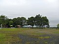
 Shaleha Princess Park
 -
 Amber Nature Park
 -
 Kandilo Plaza
 -
 TMP Daya Taka


References
[edit]- ^ "Berita | Portal Resmi Kabupaten Paser". paserkab.go.id. Retrieved 2023-04-25.
- ^ a b c Kecamatan Tanah Grogot Dalam Angka 2021 [Tanah Grogot District in Figures 2021] (in Indonesian). 2021-09-24. Retrieved 2023-04-25.
- ^ "Tanah Grogot topographic map, elevation, terrain". Topographic maps. Retrieved 2023-04-25.
- ^ "Tanah Grogot climate: Temperature Tanah Grogot & Weather By Month - Climate-Data.org". en.climate-data.org. Retrieved 2023-04-25.
- ^ "Batas Kecamatan: TANAH GROGOT". gis.dukcapil.kemendagri.go.id. Retrieved 2023-04-26.
Text is available under the CC BY-SA 4.0 license; additional terms may apply.
Images, videos and audio are available under their respective licenses.
