St. Mary, Montana
St. Mary, Montana | |
|---|---|
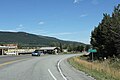
 Downtown St. Mary looking north on U.S. Route 89 | |
| Country | United States |
| State | Montana |
| County | Glacier |
| Area | |
| • Total | 0.75 sq mi (1.95 km2) |
| • Land | 0.75 sq mi (1.95 km2) |
| • Water | 0.00 sq mi (0.00 km2) |
| Population (2020) | |
| • Total | 54 |
| • Density | 71.71/sq mi (27.71/km2) |
| FIPS code | 30-65425 |
St. Mary (Blackfeet: Natoaki, "Holy Woman") is an unincorporated community on the western border of the Blackfeet Indian Reservation adjacent to Glacier National Park in Glacier County, Montana, United States. The village is the eastern terminus of the Going-to-the-Sun Road which bisects the park east to west, a distance of 53 mi (85 km).
About 54 people reside in the village year-round; however, the population increases tenfold on a busy summer evening. Several lodges, restaurants and cafés, a small grocery store, two gas stations and campgrounds are located in the village. A large housing area for National Park Service personnel is located adjacent to the village, but within the park.
U.S. Route 89 passes through the village, which lies between Saint Mary Lake in Glacier National Park and Lower St. Mary Lake on the Blackfeet Indian Reservation.
Demographics
[edit]| Census | Pop. | Note | %± |
|---|---|---|---|
| 2020 | 54 | — | |
| U.S. Decennial Census[2] | |||
Climate
[edit]This climatic region is typified by large seasonal temperature differences, with warm to hot (and often humid) summers and cold (sometimes severely cold) winters. According to the Köppen Climate Classification system, St. Mary has a humid continental climate, abbreviated "Dfb" on climate maps.[3]
| Climate data for St Mary, Montana, 1991–2020 normals, 1981-2020 extremes: 4560ft (1340m) | |||||||||||||
|---|---|---|---|---|---|---|---|---|---|---|---|---|---|
| Month | Jan | Feb | Mar | Apr | May | Jun | Jul | Aug | Sep | Oct | Nov | Dec | Year |
| Record high °F (°C) | 60 (16) |
63 (17) |
72 (22) |
82 (28) |
93 (34) |
95 (35) |
102 (39) |
99 (37) |
97 (36) |
87 (31) |
72 (22) |
58 (14) |
102 (39) |
| Mean maximum °F (°C) | 51.2 (10.7) |
52.7 (11.5) |
57.3 (14.1) |
68.5 (20.3) |
78.2 (25.7) |
84.8 (29.3) |
91.3 (32.9) |
91.2 (32.9) |
86.0 (30.0) |
73.7 (23.2) |
58.4 (14.7) |
48.8 (9.3) |
93.4 (34.1) |
| Mean daily maximum °F (°C) | 29.2 (−1.6) |
32.1 (0.1) |
37.9 (3.3) |
46.6 (8.1) |
57.2 (14.0) |
64.4 (18.0) |
75.0 (23.9) |
74.4 (23.6) |
63.2 (17.3) |
48.9 (9.4) |
36.3 (2.4) |
29.4 (−1.4) |
49.5 (9.8) |
| Daily mean °F (°C) | 20.8 (−6.2) |
22.9 (−5.1) |
28.7 (−1.8) |
36.5 (2.5) |
45.9 (7.7) |
52.5 (11.4) |
60.6 (15.9) |
59.3 (15.2) |
50.6 (10.3) |
39.9 (4.4) |
29.4 (−1.4) |
22.4 (−5.3) |
39.1 (4.0) |
| Mean daily minimum °F (°C) | 12.3 (−10.9) |
13.7 (−10.2) |
19.6 (−6.9) |
26.3 (−3.2) |
34.6 (1.4) |
40.7 (4.8) |
46.1 (7.8) |
44.2 (6.8) |
37.9 (3.3) |
30.8 (−0.7) |
22.4 (−5.3) |
15.3 (−9.3) |
28.7 (−1.9) |
| Mean minimum °F (°C) | −16.9 (−27.2) |
−10.1 (−23.4) |
−4.3 (−20.2) |
9.6 (−12.4) |
22.3 (−5.4) |
30.9 (−0.6) |
36.9 (2.7) |
33.4 (0.8) |
25.6 (−3.6) |
13.2 (−10.4) |
−1.1 (−18.4) |
−12.6 (−24.8) |
−25.0 (−31.7) |
| Record low °F (°C) | −36 (−38) |
−40 (−40) |
−29 (−34) |
−11 (−24) |
15 (−9) |
27 (−3) |
29 (−2) |
20 (−7) |
12 (−11) |
−8 (−22) |
−24 (−31) |
−38 (−39) |
−40 (−40) |
| Average precipitation inches (mm) | 2.20 (56) |
1.95 (50) |
1.69 (43) |
1.93 (49) |
2.88 (73) |
3.37 (86) |
1.53 (39) |
1.63 (41) |
2.18 (55) |
2.05 (52) |
2.47 (63) |
2.21 (56) |
26.09 (663) |
| Average snowfall inches (cm) | 15.5 (39) |
18.6 (47) |
15.9 (40) |
13.2 (34) |
4.8 (12) |
1.0 (2.5) |
0.0 (0.0) |
0.0 (0.0) |
1.7 (4.3) |
8.5 (22) |
17.8 (45) |
20.8 (53) |
117.8 (298.8) |
| Average extreme snow depth inches (cm) | 12.8 (33) |
13.0 (33) |
11.6 (29) |
7.1 (18) |
2.7 (6.9) |
0.6 (1.5) |
0.0 (0.0) |
0.0 (0.0) |
0.2 (0.51) |
3.3 (8.4) |
8.8 (22) |
9.7 (25) |
20.4 (52) |
| Source 1: NOAA (1981-2010 precip/snowfall)[4][5] | |||||||||||||
| Source 2: XMACIS2 (records, monthly max/mins & 1981-2010 snow depth)[6] | |||||||||||||
See also
[edit]Images
[edit]-
 Looking north at the sign for St. Mary
 -
 Panorama for St. Mary
 -
 Looking south at St. Mary's sign


References
[edit]- ^ "ArcGIS REST Services Directory". United States Census Bureau. Retrieved September 18, 2022.
- ^ "Census of Population and Housing". Census.gov. Retrieved June 4, 2016.
- ^ Climate Summary for St. Mary, Montana, weatherbase.com; accessed January 16, 2018.
- ^ "St Mary, Montana 1991-2020 Monthly Normals". Retrieved August 14, 2023.
- ^ "St Mary, Montana 1981-2010 Monthly Normals". Retrieved January 11, 2024.
- ^ "xmACIS". National Oceanic and Atmospheric Administration. Retrieved January 11, 2024.
External links
[edit]- TopoQuest. "USGS Saint Mary Quad". Retrieved July 5, 2008.
48°44′37″N 113°25′42″W / 48.7436°N 113.4284°W
Municipalities and communities of Glacier County, Montana, United States | ||
|---|---|---|
| City |  | |
| Town | ||
| CDPs | ||
| Indian reservation | ||
| Footnotes | ‡This populated place also has portions in an adjacent county or counties | |
Text is available under the CC BY-SA 4.0 license; additional terms may apply.
Images, videos and audio are available under their respective licenses.
