Sint-Amandsberg
Sint-Amandsberg | |
|---|---|
 Center of Sint-Amandsberg, with former town hall and church of Saint Amand | |
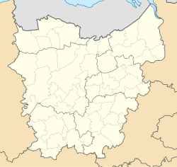
 Location of Sint-Amandsberg in Ghent | |
| Coordinates: 51°03′14″N 3°44′57″E / 51.05389°N 3.74917°E | |
| Country | |
| Community | |
| Region | |
| Province | |
| Arrondissement | Ghent |
| Municipality | Ghent |
| Area | |
| • Total | 5.99 km2 (2.31 sq mi) |
| Population (2020-01-01) | |
| • Total | 32,151 |
| • Density | 5,400/km2 (14,000/sq mi) |
| Postal codes | 9040 |
| Area codes | 09 |
Sint-Amandsberg (Dutch pronunciation: [ˌsɪnt ɑˈmɑntsˌbɛr(ə)x]; French: Mont-Saint-Amand) is a sub-municipality of the city of Ghent located in the province of East Flanders, Flemish Region, Belgium. The municipality of Sint-Amandsberg was formed in 1872, when it was detached from the municipality of Oostakker.[1] In 1876 and 1900, parts of the original municipality were already annexed to Ghent.[2] On 1 January 1977, the municipality of Sint-Amandsberg was merged into Ghent.[3]
It is served by the Bus and train station of Gent Dampoort on the Ghent Antwerp NMBS/SNCB line.
During the First World War, on 7 June 1915, the German airschip LZ37 crashed after being destroyed by Reginald Warneford. A street was named Reginald Warnefordstraat on the spot where the airship crashed.

Campo Santo
[edit]In the Center is the famous Campo Santo, a Catholic burial site. The chapel on the hill was erected by Philips Erard van der Noot.
References
[edit]- ^ "Oostakker". inventaris.onroerenderfgoed.be (in Dutch). 1 June 1975. Retrieved 28 January 2024.
- ^ "Gent - 19de- en 20ste-eeuwse stadsuitbreiding". inventaris.onroerenderfgoed.be (in Dutch). 1 June 1975. Retrieved 28 January 2024.
- ^ "LISTE ALPHABETIQUE DES COMMUNES - Fusions de 1963 à 1977" (PDF).
| International | |
|---|---|
| National | |
| Geographic | |
Text is available under the CC BY-SA 4.0 license; additional terms may apply.
Images, videos and audio are available under their respective licenses.


