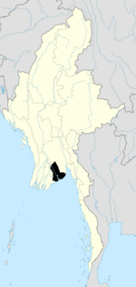
Sanchaung Township
Sanchaung Township
စမ်းချောင်းမြို့နယ် | |
|---|---|
Township of Yangon | |
| Sanchaung Township | |
 Myaynigone Flyover | |
| Coordinates: 16°48′23″N 96°8′6″E / 16.80639°N 96.13500°E | |
| Country | Myanmar |
| Division | Yangon |
| City | Yangon |
| Township | Sanchaung |
| Area | |
| • Total | 2.47 km2 (0.955 sq mi) |
| Population (2014) | |
| • Total | 99,619 |
| • Density | 40,000/km2 (100,000/sq mi) |
| Time zone | UTC6:30 (MST) |
| Postal codes | 11111 |
| Area code(s) | 1 (mobile: 80, 99) |
| YCDC[1] | |
Sanchaung Township (Burmese: စမ်းချောင်းမြို့နယ် [sáɰ̃dʑáʊɰ̃ mjo̰nɛ̀]) is in the north central part of Yangon. The township comprises 18 wards, and shares borders with Kamayut Township in the north, Kamayut township and Bahan Township in the east, Kyimyindaing Township in the west, and Dagon Township and Ahlon Township in the south. The township has 19 primary schools, two middle schools and four high schools. Dagon Center I and II are shopping malls inside the township, where there are many restaurants, fashion shops, and Mingalar Cinema. Other recreational spaces include Happy World recreation center and People's Park.[1] Sanchaung is known as "Little Kachin".
Landmarks
[edit]The following is a list of landmarks protected by the city in Sanchaung township.[2]
| Structure | Type | Address | Notes |
|---|---|---|---|
| Anglican Religious Training Center | Office | 196 Kyundaw Lane | |
| BEHS 2 Sanchaung | School | 29 Pyay Road | Former St. Philomena's Convent High School |
| Catholic Bishops' Conference of Myanmar | School | 292-A Pyay Road | |
| Chinese Buddhist Nuns’ Temple | Temple | 35 Tayok Kyaung Lane | |
| Kodatgyi Pagoda | Pagoda | Bagaya Lane | |
| Kyimyindaing Railway Station | Rail Station | 292-A Pyay Road | Kyimyindaing Railway Station Lane |
| Kyundaw Ordination Hall | Monastery | Bagaya Lane | |
| Myenigon Jamah Mosque | Mosque | 248 Bagaya Lane | |
| Okkyaung Bagaya Monastery | Monastery | 241 U Wisara Lane | |
| Sarpay Beikman | Office | 361 Pyay Road | |
| Weluwun Monastery | Monastery | Weluwun Lane | |
| Zeyawadi Monastery | Monastery | Zeyawadi Lane | |
| Dagon Center I and II | Shopping Mall | Bagaya Lane | |
| Mahar Myaing Hospital | Hospital | Myay Nu Street |
References
[edit]- ^ a b "Sanchaung Township". Yangon City Development Committee. Archived from the original on 2 October 2011. Retrieved 2009-03-15.
- ^ "Special Reports: Heritage List". The Myanmar Times. 2001-10-29. Archived from the original on 15 June 2009.
Capital: Yangon | |
| East Yangon District | |
| North Yangon District | |
| South Yangon District | |
| West Yangon District (Downtown) | |
1 - part of South Yangon City; 2 - part of North Yangon City | |
Capital: Yangon | ||
| East Yangon District | ||
| North Yangon District | ||
| South Yangon District | ||
| West Yangon District (Downtown) | ||
| Main cities and towns | ||
1 - part of South Yangon City; 2 - part of North Yangon City | ||
| States | ||
|---|---|---|
| Regions | ||
| Self-Administered Zones | ||
| Self-Administered Divisions | ||
| Union Territories | ||
Text is available under the CC BY-SA 4.0 license; additional terms may apply.
Images, videos and audio are available under their respective licenses.


