Nundroo, South Australia
| Nundroo South Australia | |
|---|---|
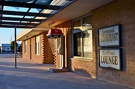
 The Nundroo Roadhouse, 2017 | |
| Coordinates | 31°47′9″S 132°12′54″E / 31.78583°S 132.21500°E |
| Postcode(s) | 5690 |
| Time zone | ACST (UTC+9:30) |
| • Summer (DST) | ACST (UTC+10:30) |
| Location |
|
| LGA(s) | Pastoral Unincorporated Area[1] |
| Region | Eyre and Western[2] |
| State electorate(s) | Flinders[3] |
| Federal division(s) | Grey[4] |
Nundroo is a small South Australian town, located approximately 1,014 kilometres (630 mi) west of Adelaide. It is a popular rest stop for travellers due to its location on the Eyre Highway.
The area was settled by sheep graziers in the 1860s. By the 1870s the Nundroo sheep station had been incorporated in the larger Yalata and Fowlers Bay sheep runs. In the following decade these vast runs were broken up as the original pastoral leases expired, opening the area up to such activities as grain farming.
As an agriculture based town, its industries include sheep production and grain growing farming.[5][6] Nundroo has its motel, Nundroo Hotel Motel opened in 1957 and a roadhouse, the Nundroo Roadhouse, used a transient stop to Eucla and other nearby towns Coorabie, Bookabie, Fowlers Bay, Koonibba and the major town of Ceduna.[7]
See also
[edit]References
[edit]- ^ "Search result for "Nundroo (LOCU)" (Record no SA0051227) with the following layers selected – "Suburbs and Localities" and " Place names (gazetteer)"". Property Location Browser. Government of South Australia. Archived from the original on 12 October 2016. Retrieved 23 July 2016.
- ^ "Eyre Western SA Government region" (PDF). The Government of South Australia. Retrieved 10 October 2014.
- ^ "District of Flinders Background Profile". Electoral Commission SA. Retrieved 9 September 2015.
- ^ "Federal electoral division of Grey, boundary gazetted 16 December 2011" (PDF). Australian Electoral Commission. Retrieved 20 August 2015.
- ^ Collins, J. (2007). "Coorabie and Districts Community Plan" (PDF). Outback Areas Community Development Trust. Archived from the original (PDF) on 30 September 2009. Retrieved 7 November 2009.
- ^ "Grain growers expecting above average yields". Australia: ABC News. 6 October 2006. Retrieved 7 November 2009.
- ^ "Communities – Coorabie". Outback Areas Community Development Trust. 2003–2007. Archived from the original on 14 September 2009. Retrieved 7 November 2009.
External links
[edit]![]() Media related to Nundroo, South Australia at Wikimedia Commons
Media related to Nundroo, South Australia at Wikimedia Commons
Named locations on the Nullarbor Plain, Australia | |
|---|---|
| Western Australia (along Eyre Highway) | |
| South Australia (along Eyre Highway) | |
| Western Australia (along Trans-Australian Railway) | |
| South Australia (along Trans-Australian Railway ) | |
Text is available under the CC BY-SA 4.0 license; additional terms may apply.
Images, videos and audio are available under their respective licenses.

