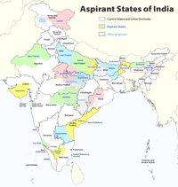
Karaikal district
Karaikal district | |
|---|---|
 | |
| Coordinates: 11°01′00″N 79°52′00″E / 11.01667°N 79.86667°E | |
| Country | |
| Union Territory | Puducherry |
| District | Karaikal |
| Area | |
| • Total | 161 km2 (62 sq mi) |
| Population (2011)[1] | |
| • Total | 200,222 |
| • Density | 1,200/km2 (3,200/sq mi) |
| Languages | |
| • Official | Tamil,[2] English,[2] |
| • Additional | French,[3] |
| Time zone | UTC+5:30 (IST) |
| PIN | 609 602 |
| Telephone code | 91 (0)4368 |
| Vehicle registration | PY-02 |
| Website | karaikal |
Karaikal district (French: District de Karikal) is one of the four districts of the Union Territory of Puducherry in India.
Etymology
[edit]The origin of the word Karaikal is uncertain. The Imperial Gazetteer of British India gives its meaning as 'fish pass'. Both the words 'Karai' and 'Kal' have several meanings, of which the more acceptable ones are 'lime mix' and 'canal' respectively. Hence it has been suggested that the name may mean a canal built of lime mix, however, no trace of such a canal is evident.
Geography
[edit]Karaikal district occupies an area of 160 square kilometres (62 sq mi).[4]
Karaikal is a small coastal enclave of territory which was formerly part of French India. Together with the other former French enclaves of Pondicherry, Yanam, and Mahé, Karaikal forms the Union Territory of Puducherry. Karaikal is bounded on the North by Mayiladuthurai district, on the South by Nagapattinam district of Tamil Nadu state, on the west by Tiruvarur district (also belonging to Tamil Nadu), and on the East by the Bay of Bengal.
Demographics
[edit]According to the 2011 census Karaikal district has a population of 200,222,[5] roughly equal to the nation of Samoa.[6] This gives it a ranking of 589th in India (out of a total of 640).[5] The district has a population density of 1,252 inhabitants per square kilometre (3,240/sq mi) .[5] Its population growth rate over the decade 2001-2011 was 17.29%.[5] Karaikal has a sex ratio of 1048 females for every 1000 males,[5] and a literacy rate of 87.83%.[5]
Tamil is the principal language spoken and Tamils are the predominant linguistic group in the district.
Hindus formed the majority of the population at 83.41% of the population followed by Christians at 10.70%, Muslims at 6.46% and others at 0.12%.[7]
Transportation
[edit]- Air
The nearest airport is in Trichy (Tiruchirappalli). Karaikal Airport is a greenfield airport under construction. It will be the first airport in the country to be built entirely with private capital.[8][better source needed]
- Train
Karaikal railway station is a railway terminus, situated in the town of Karaikal in the Union Territory of Puducherry, India.[9]
- Port
Karaikal Port Private Limited (KPPL), a private port developed by the Chennai-based MARG Limited, became operational in April 2009. The port is located on the Eastern coast of India at keezhavanjore village in Karaikal District of Puducherry, around 300 km along the coast south of Chennai Port and around 360 km along the coast north of Tuticorin Port. The shoreline of the port is between 10° 50′ 56″ N and 10° 49′ 44″ N.[10]
Educational institutions
[edit]See also
[edit]References
[edit]- ^ a b "Official website of Karaikal District, Puducherry UT". Archived from the original on 12 September 2016. Retrieved 3 September 2016.
- ^ a b "The Pondicherry Official Languages Act, 1965" (PDF). lawsofindia.org. Laws of India. Archived from the original (PDF) on 3 May 2020. Retrieved 10 June 2019.
- ^ Animesh Rai (2020). The Legacy of French Rule in India (1674-1954): An investigation of a process of Creolization. Institut français de Pondichéry. ISBN 9791036549892.
- ^ Srivastava, Dayawanti, ed. (2010). "States and Union Territories: Pondicherry: Government". India 2010: A Reference Annual (54th ed.). New Delhi, India: Additional Director General, Publications Division, Ministry of Information and Broadcasting (India), Government of India. p. 1222. ISBN 978-81-230-1617-7.
- ^ a b c d e f "District Census 2011". Census2011.co.in. 2011. Retrieved 30 September 2011.
- ^ US Directorate of Intelligence. "Country Comparison:Population". Archived from the original on 13 June 2007. Retrieved 1 October 2011.
Samoa 193,161
- ^ "New Page 1". Archived from the original on 16 July 2009. Retrieved 29 November 2009.
- ^ "Coimbatore firm to build India's first private airport in Karaikal". The Times of India. 13 March 2012. Archived from the original on 10 May 2013. Retrieved 3 July 2012.
- ^ "Nagore-Karaikal BG line inspection by September". The Hindu. Chennai, India. 8 July 2011.
- ^ http://www.karaikalport.com/
Places adjacent to Karaikal district | ||||||||||||||||
|---|---|---|---|---|---|---|---|---|---|---|---|---|---|---|---|---|
| ||||||||||||||||
| Former |
| ||||||||||||||||||||||||||||||||||||||||
|---|---|---|---|---|---|---|---|---|---|---|---|---|---|---|---|---|---|---|---|---|---|---|---|---|---|---|---|---|---|---|---|---|---|---|---|---|---|---|---|---|---|
| Present |
| ||||||||||||||||||||||||||||||||||||||||
| Districts | |||||
|---|---|---|---|---|---|
| Municipalities | |||||
| Languages | |||||
| Education | |||||
| History | |||||
| Places of interest | |||||
| Transport |
| ||||
| Sports | |||||
| Central India |
| |
|---|---|---|
| East India | ||
| North India |
| |
| Northeast India |
| |
| South India |
| |
| West India |
| |
Text is available under the CC BY-SA 4.0 license; additional terms may apply.
Images, videos and audio are available under their respective licenses.


