Kamphaeng Phet province
Kamphaeng Phet
กำแพงเพชร | |
|---|---|
| Kamphaeng Phet Province จังหวัดกำแพงเพชร | |
From left to right, top to bottom: Kamphaeng Phet Historical Park, Wat Chang Rob, Khlong Lan Waterfall, Wat Phra Bommathat, Wat Thung Sanun Rattanaram, Mae Wong National Park | |
 Flag .png) Seal | |
| Nickname(s): Chakungrao (Thai: ชากังราว) Mueang Kluai Khai (city of lady finger bananas) | |
| Motto(s): กรุพระเครื่อง เมืองคนแกร่ง พระแสงฯ ล้ำค่า ศิลาแลงใหญ่ กล้วยไข่หวาน น้ำมันลานกระบือ เลื่องลือมรดกโลก ("Buddha amulets repository. City of the strong. Precious Phra Saeng swords. Large laterite slabs, Sweet lady finger bananas. Lan Krabue oil. Renowned world heritage.") | |
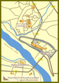
 Location of Kamphaeng Phet in Thailand | |
| Coordinates: 16°33′29″N 99°30′40″E / 16.55806°N 99.51111°E | |
| Country | |
| Established | 1916 |
| Capital | Kamphaeng Phet |
| Subdivisions | 11 districts |
| Government | |
| • Governor | Chathip Ruchanaseri (since October 2022) |
| Area | |
| • Total | 8,607.49 km2 (3,323.37 sq mi) |
| • Rank | 22nd |
| Population (2021) | |
| • Total | |
| • Rank | 37th |
| • Density | 82.74/km2 (214.3/sq mi) |
| • Rank | 54th |
| Human Achievement Index | |
| • HAI (2022) | 0.6283 "somewhat low" Ranked 58th |
| GDP | |
| • Total | baht 110 billion (US$3.8 billion) (2019) |
| Time zone | UTC+07:00 (ICT) |
| Website | www |


Kamphaeng Phet (Thai: กำแพงเพชร, pronounced [kām.pʰɛ̄ːŋ pʰét]) is a province in upper central Thailand. It borders the provinces of Sukhothai to the north; Phitsanulok to the northeast; Phichit to the east; Nakhon Sawan to the south; and Tak to the west and northwest, covering over 8,607.49 square kilometres (3,323.37 sq mi) and is the fourth-largest provinces in central Thailand. Kamphaeng Phet has the Ping River flow through is main river of the province, making river flats make up much of the east of the province, while the west is mountainous which is part of Dawna Range and it covered with plentifully forest. Kamphaeng Phet known its natural environment and has a long history. National and historical parks in the province include Kamphaeng Phet Historical Park, Khlong Lan National Park, and Mae Wong National Park.
Toponymy
In Thai or Lao kamphaeng means 'wall' and phet (from Sanskrit vájra) means 'diamond'. The name means 'wall as hard as diamond'. This wall served as a defensive line to protect the Ayutthaya Kingdom from what is now modern-day Burma. The old name was Khao Kampeng, referring to a 'mountain wall' between the two countries.
Geography
The main river is the Ping, a major tributary of the Chao Phraya River. River flats make up much of the east of the province, while the west is mountainous and covered with forests. The total forest area is 1,997 km2 (771 sq mi) or 23.5 percent of provincial area.[3]
One of the provinces best-known products is bananas, especially the kluai khai, a small, round, sweet banana. Banana festivals are held every year to thank the spirits for the harvest.
National parks
There area three national parks make up region 12 (Nakhon Sawan) of Thailand's protected areas.
- Mae Wong National Park, 894 km2 (345 sq mi)[4]: 54
- Khlong Wang Chao National Park, 747 km2 (288 sq mi)[4]: 63
- Khlong Lan National Park, 300 km2 (120 sq mi)[4]: 44
Wildlife sanctuary
- Khao Sanam Phriang Wildlife Sanctuary, 101 km2 (39 sq mi)[5]: 1
History
Kamphaeng Phet was already a royal city in the Sukhothai Kingdom in the 14th century, then known under its old name Chakangrao. It formed an important part of the defence system of the kingdom, as well as of the later Ayutthaya Kingdom.
Symbols
The provincial seal shows the city walls surmounted by diamonds, since the city name means 'diamond wall' (from the shape of the ramparts of the old city wall). The provincial tree is the areca nut palm (Acacia catechu), and the provincial flower the bullet wood (Mimusops elengi). Golden belly barb (Hypsibarbus wetmorei) is provincial fish, since it is a fish found in the Ping river especially in the area of Kamphaeng Phet.[6]
Administrative divisions

Provincial government
The province is divided into 11 districts (amphoes). These are further divided into 78 subdistricts (tambons) and 823 villages (mubans).
Local government
As of 26 November 2019 there are:[7] one Kamphaeng Phet Provincial Administration Organisation (ongkan borihan suan changwat) and 25 municipal (thesaban) areas in the province. Kamphaeng Phet, Pang Makha and Nong Pling have town (thesaban mueang) status. Further 22 subdistrict municipalities (thesaban tambon). The non-municipal areas are administered by 64 Subdistrict Administrative Organisations - SAO (ongkan borihan suan tambon).[8]
Human achievement index 2022
| Health | Education | Employment | Income |
| 39 | 70 | 71 | 13 |
| Housing | Family | Transport | Participation |

|
 |
.png)
| |
| 30 | 25 | 73 | 35 |
| Province Kamphaeng Phet, with an HAI 2022 value of 0.6283 is "somewhat low", occupies place 58 in the ranking. | |||
Since 2003, United Nations Development Programme (UNDP) in Thailand has tracked progress on human development at sub-national level using the Human achievement index (HAI), a composite index covering all the eight key areas of human development. National Economic and Social Development Board (NESDB) has taken over this task since 2017.[1]
| Rank | Classification |
| 1–13 | "High" |
| 14–29 | "Somewhat high" |
| 30–45 | "Average" |
| 46–61 | "Somewhat low" |
| 62–77 | "Low" |
| Map with provinces and HAI 2022 rankings |

|
Notable residents
- Tossapol Himmapan: singer
- Saman Sorjaturong: WBC & IBF light flyweight world champion
- Kaeo Pongprayoon: 2012 Summer Olympics silver medalist
- Chatchai Budprom: footballer
- Wattana Playnum: footballer
- Supattra Pairoj: volleyball player
- Somporn Yos: footballer
Popular culture
Kamphaeng Phet was mentioned in crime fiction Sarawat Yai as the backdrop of the whole story. It was adapted into a television drama of the same name twice on Channel 7, in 1994 and 2019. In the versions of both television dramas, Kamphaeng Phet was changed to be called Phra Kamphaeng (พระกำแพง, pronounced [pʰráʔ kām.pʰɛ̄ːŋ]).[9][10]
Gallery
-
 Banana Festival
 -


Text is available under the CC BY-SA 4.0 license; additional terms may apply.
Images, videos and audio are available under their respective licenses.
