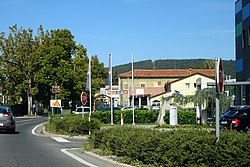
Hrpelje
Hrpelje | |
|---|---|
 | |
| Coordinates: 45°36′11.24″N 13°56′51.94″E / 45.6031222°N 13.9477611°E | |
| Country | |
| Traditional region | Littoral |
| Statistical region | Coastal–Karst |
| Municipality | Hrpelje-Kozina |
| Area | |
| • Total | 5.42 km2 (2.09 sq mi) |
| Elevation | 502 m (1,647 ft) |
| Population (2002) | |
| • Total | 665 |
| [1] | |
Hrpelje (pronounced [xəɾˈpeːljɛ] , in older sources Herpelje;[2] Italian: Erpelle) is a settlement in the Municipality of Hrpelje-Kozina in the Littoral region of Slovenia. It is the administrative center of the municipality.[3]
Geography
[edit]Hrpelje is located in a heavily karstified area with many sinkholes, depressions, and shafts. Among them is the Hrpelje Sinkhole (Slovene: Hrpeljski dol) or Church Sinkhole (Slovene: Cerkveni dol) on the western edge of the village. It is 94 meters (308 ft) deep, and until 1949 its 6,000-square-meter (65,000 sq ft) bottom was divided into 29 fields cultivated by 19 smallholders, who mainly grew cabbage and potatoes on the plots. Under the postwar communist regime, the land was assigned to the Hrpelje Collective Farm (Slovene: Kmetijska zadruga Hrpelje).[4]
Name
[edit]Hrpelje was attested in historical sources as Herpelie and Herpelye in 1763–1787. The name may be derived from the plural demonym *Vьrpeľane based on the common noun *vьrpa 'sinkhole', thus originally meaning 'people living near a sinkhole'. If so, the initial H- is prothetic.[5]
Church
[edit]The parish church in the settlement is dedicated to Saint Anthony the Hermit and belongs to the Koper Diocese.[6]
References
[edit]- ^ Statistical Office of the Republic of Slovenia
- ^ Spezialortsrepertorium der österreichischen Länder. Bearbeitet auf Grund der Ergebnisse der Volkszählung vom 31. Dezember 1910, vol. 7: Österreichisch-Illyrisches Küstenland. Vienna: K. k. Hof- und Staatsdruckerei. 1918. p. 60.
- ^ Hrpelje-Kozina municipal site Archived 2008-12-18 at the Wayback Machine
- ^ Savnik, Roman (1968). Krajevni leksikon Slovenije, vol. 1. Ljubljana: Državna založba Slovenije. pp. 313–314.
- ^ Snoj, Marko (2009). Etimološki slovar slovenskih zemljepisnih imen. Ljubljana: Modrijan. p. 164.
- ^ Roman Catholic Diocese of Koper List of Churches May 2008 Archived 2009-03-06 at the Wayback Machine
External links
[edit] Media related to Hrpelje at Wikimedia Commons
- Hrpelje on Geopedia
Text is available under the CC BY-SA 4.0 license; additional terms may apply.
Images, videos and audio are available under their respective licenses.


