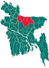
Gouripur Upazila
Gouripur
গৌরীপুর | |
|---|---|
 | |
| Coordinates: 24°45.5′N 90°34.5′E / 24.7583°N 90.5750°E | |
| Country | |
| Division | Mymensingh |
| District | Mymensingh |
| Area | |
| • Total | 276.74 km2 (106.85 sq mi) |
| Population (2011) | |
| • Total | 323,057 |
| • Density | 1,200/km2 (3,000/sq mi) |
| Time zone | UTC+6 (BST) |
| Website | Official Map of Gouripur |
Gouripur (Bengali: গৌরীপুর) is an upazila located in the Mymensingh District of Bangladesh.[1]
Demographics
[edit]| Religions in Gouripur upazila (2011)[2] | ||||
|---|---|---|---|---|
| Religion | Percent | |||
| Islam | 95.97% | |||
| Hinduism | 3.92% | |||
| Other or not stated | 0.11% | |||
According to the 2011 Bangladesh census, Gouripur Upazila had 72,047 households and a population of 323,057. 86,603 (26.81%) were under 10 years of age. Gouripur has a literacy rate (age 7 and over) of 43.64%, compared to the national average of 51.8%, and a sex ratio of 1023 females per 1000 males. 25,570 (7.92%) lived in urban areas.[3][2]
At the 1991 Bangladesh census, Gauripur had a population of 247945, of whom 125,167 were aged 18 or older. Males constituted 50.71% of the population, and females 49.29%. Gauripur had an average literacy rate of 26.4% (7+ years), against the national average of 32.4%.[4]
Administration
[edit]Gouripur Upazila is divided into Gouripur Municipality and ten union parishads: Achintapur, Bhangnamari, Bokainagar, Douhakhola, Gouripur, Mailakanda, Maoha, Ramgopalpur, Sahanati, and Sidhla. The union parishads are subdivided into 245 mauzas and 289 villages.[5]
Gouripur Municipality is subdivided into 9 wards and 34 mahallas.[5]
Notable people
[edit]- Abdul Wahed Bokainagari, politician
See also
[edit]References
[edit]- ^ Sahidur Rahman (2012), "Gauripur Upazila", in Sirajul Islam and Ahmed A. Jamal (ed.), Banglapedia: National Encyclopedia of Bangladesh (Second ed.), Asiatic Society of Bangladesh
- ^ a b "Bangladesh Population and Housing Census 2011 Zila Report – Mymensingh" (PDF). bbs.gov.bd. Bangladesh Bureau of Statistics.
- ^ "Community Tables: Mymensingh district" (PDF). bbs.gov.bd. 2011.
- ^ "Population Census Wing, BBS". Archived from the original on 2005-03-27. Retrieved November 10, 2006.
- ^ a b "District Statistics 2011: Mymensingh" (PDF). Bangladesh Bureau of Statistics. Archived from the original (PDF) on 13 November 2014. Retrieved 14 July 2014.
Headquarters: Mymensingh | ||
| Jamalpur District | ||
| Mymensingh District | ||
| Netrokona District | ||
| Sherpur District | ||
Text is available under the CC BY-SA 4.0 license; additional terms may apply.
Images, videos and audio are available under their respective licenses.

