Galya-tető
| Galya-tető | |
|---|---|
 Galya-tető from the Kékes | |
| Highest point | |
| Elevation | 965 m (3,166 ft)[1] |
| Prominence | 349 m (1,145 ft)[2] |
| Coordinates | 47°55′N 19°54′E / 47.917°N 19.900°E |
| Naming | |
| English translation | Treeless top |
| Language of name | Hungarian |
| Geography | |
| Parent range | Mátra, Western Carpathians |
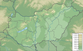
Galya-tető [ˈɡɒjɒtɛtøː] (Slovak: Matranská hoľa) is the second highest mountain (altitude: 965 m) in Hungary and in the Mátra mountain range (after Kékes). Galya-tető is a resort place of the village of Mátraszentimre in Heves County. The territory of Galyatető have an own postal code: 3234. It is 5.0 km away from the town center. As of 2022 census, it has a population of 43.[3] The resort place reachable by bus from the capital city.[4]
History
[edit]The Mátra Association established a hostel here in 1894 and an andesite watchtower was erected on the Péter-hegyese mountain to the east of the Galya-tető in 1934. The hostel ruined and a new luxury hotel was built under the Péter-hegyese watchtower in 1939. The Church of Patrona Hungariae built on the Galya-tető in 1941. Galya-tető was annexed to Mátraszentimre in 1948. The importance of tourism increased in the 1960s and hotels and ski slopes were built here. The observatory was built on the Piszkés-tető mountain in 1960, what is west from Galya-tető and has been open to visitors since 2013. However the ski slopes are unusable already, but the watchtower renewed in 2015 and a new hostel was established. The new hostel is the stamping place of the National Blue Trail.[5][6]
Gallery
[edit]-
Patrona Hungariae Church
-
Péter hegyese watchtower
References
[edit]- ^ "Galya-tető". Retrieved 2024-02-14.
- ^ "Galya-tető". Retrieved 2024-02-14.
- ^ "Mátraszentimre". ksh.hu. Hungarian Central Statistical Office. Retrieved 14 February 2024.
- ^ "Budapest-Fallóskút". volanbusz.hu (in Hungarian). Volánbusz. Retrieved 1 March 2024.
- ^ Habán, Ildikó (2015). Mátraszentimre. In.: Mátra tursitakaluz (in Hungarian). Budapest: Cartographia. p. 21-22. ISBN 978-963-353-143-3.
- ^ "History" (in Hungarian). Retrieved 14 February 2024.
Text is available under the CC BY-SA 4.0 license; additional terms may apply.
Images, videos and audio are available under their respective licenses.


