File:Mosby'sConf.Map.jpg
Size of this preview: 652 × 599 pixels. Other resolutions: 261 × 240 pixels | 522 × 480 pixels | 836 × 768 pixels | 1,221 × 1,122 pixels.
Original file (1,221 × 1,122 pixels, file size: 1.22 MB, MIME type: image/jpeg)
| This is a file from the Wikimedia Commons. Information from its description page there is shown below. Commons is a freely licensed media file repository. You can help. |
Summary
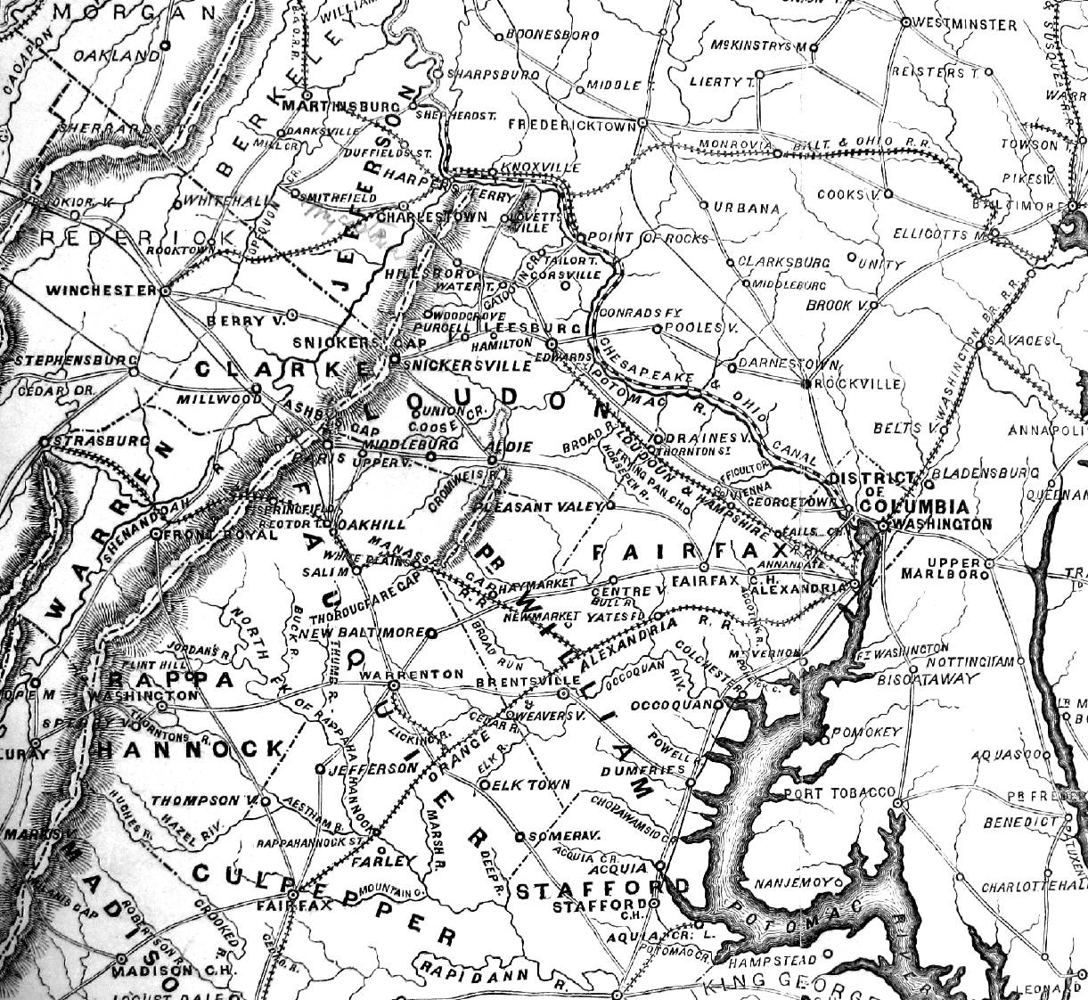
| Description | Map of Mosby's Confederacy printed in 1867, showing contemporary place names |
| Date | |
| Source | Major John Scott, Partisan Life with Col. John S. Mosby (New York: Harper & Bros. Publishers, 1867) |
| Author | Harper & Bros. Publishers |
| Permission (Reusing this file) |
public source, free use permited |
Licensing
This media file is in the public domain in the United States. This applies to U.S. works where the copyright has expired, often because its first publication occurred prior to January 1, 1929, and if not then due to lack of notice or renewal. See this page for further explanation.
|
 | |
 |
This image might not be in the public domain outside of the United States; this especially applies in the countries and areas that do not apply the rule of the shorter term for US works, such as Canada, Mainland China (not Hong Kong or Macao), Germany, Mexico, and Switzerland. The creator and year of publication are essential information and must be provided. See Wikipedia:Public domain and Wikipedia:Copyrights for more details.
|
File history
Click on a date/time to view the file as it appeared at that time.
| Date/Time | Thumbnail | Dimensions | User | Comment | |
|---|---|---|---|---|---|
| current | 17:23, 30 March 2010 | | 1,221 × 1,122 (1.22 MB) | ElijahBosley | ((Information |Description=Map of Mosby's Confederacy printed in 1867, showing contemporary place names |Source= Major John Scott, Partisan Life with Col. John S. Mosby (New York: Harper & Bros. Publishers, 1867) |Date=1867 |Author=Harper & Bros. Publishe |
File usage
The following pages on the English Wikipedia use this file (pages on other projects are not listed):
Global file usage
The following other wikis use this file:
- Usage on kk.wikipedia.org
- Usage on ru.wikipedia.org
Metadata
Text is available under the CC BY-SA 4.0 license; additional terms may apply.
Images, videos and audio are available under their respective licenses.
Cover photo is available under {{::mainImage.info.license.name || 'Unknown'}} license.
Cover photo is available under {{::mainImage.info.license.name || 'Unknown'}} license.
Credit:
(see original file).
