File:Map of the Eastern British Provinces in North America at the time of Confederation 1867.jpg
Size of this preview: 738 × 600 pixels. Other resolutions: 295 × 240 pixels | 591 × 480 pixels | 945 × 768 pixels | 1,260 × 1,024 pixels | 1,600 × 1,300 pixels.
Original file (1,600 × 1,300 pixels, file size: 2.56 MB, MIME type: image/jpeg)
| This is a file from the Wikimedia Commons. Information from its description page there is shown below. Commons is a freely licensed media file repository. You can help. |
Summary
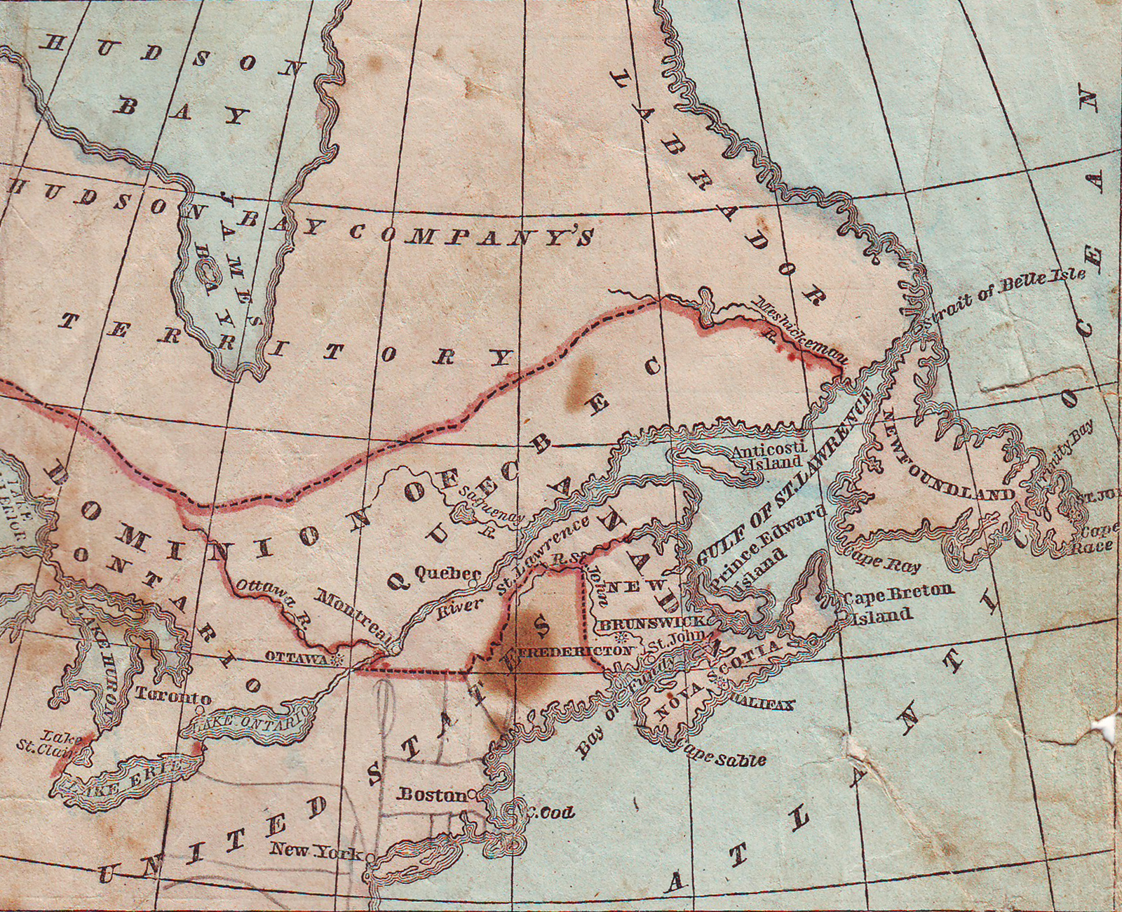
| Description | Map of the Eastern British Provinces in North America at the time of Confederation 1867 |
| Date | (map); August 19, 2013 (Digital image) |
| Source |
Cornell, Sarah S. "Cornell's Primary Geography" (Revised Edition) p. 73 New York: D. Appleton & Co 1867 "The Cooper Collections" (uploader's private collection) Digitized by Centpacrr |
| Author | Sarah S. Cornell |
Licensing
This media file is in the public domain in the United States. This applies to U.S. works where the copyright has expired, often because its first publication occurred prior to January 1, 1929, and if not then due to lack of notice or renewal. See this page for further explanation.
|
 | |
 |
File history
Click on a date/time to view the file as it appeared at that time.
| Date/Time | Thumbnail | Dimensions | User | Comment | |
|---|---|---|---|---|---|
| current | 17:02, 19 August 2013 | | 1,600 × 1,300 (2.56 MB) | Centpacrr | == Summary == ((Information | Description=Map of the Eastern British Provinces in North America at the time of Confederation 1867 | Source=Cornell, Sarah S. "Cornell's Primary Geography" (Revised Edition) p. 73 New York: D. Appleton & Co 1867 "The Coop... |
File usage
The following pages on the English Wikipedia use this file (pages on other projects are not listed):
Metadata
Text is available under the CC BY-SA 4.0 license; additional terms may apply.
Images, videos and audio are available under their respective licenses.
Cover photo is available under {{::mainImage.info.license.name || 'Unknown'}} license.
Cover photo is available under {{::mainImage.info.license.name || 'Unknown'}} license.
Credit:
(see original file).
