File:LocationMali.png
No higher resolution available.
LocationMali.png (250 × 115 pixels, file size: 6 KB, MIME type: image/png)
| This is a file from the Wikimedia Commons. Information from its description page there is shown below. Commons is a freely licensed media file repository. You can help. |
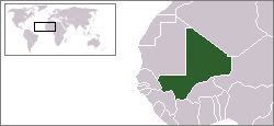
Location map for the Mali.
Originally created for English Wikipedia by Vardion.
| |
This work has been released into the public domain by its author, Vardion, at the English Wikipedia project. This applies worldwide. In case this is not legally possible: |

|
File:LocationMali.svg is a vector version of this file. It should be used in place of this PNG file when not inferior.
File:LocationMali.png → File:LocationMali.svg
For more information, see Help:SVG. |
 |
File history
Click on a date/time to view the file as it appeared at that time.
| Date/Time | Thumbnail | Dimensions | User | Comment | |
|---|---|---|---|---|---|
| current | 14:28, 4 December 2007 | | 250 × 115 (6 KB) | Gandal el gris | Reverted to version as of :, 0 <> |
| 11:29, 4 December 2007 |  | 250 × 115 (5 KB) | Tetouancity | Reverted to version as of 11:55, 15 November 2007 | |
| 07:02, 19 November 2007 |  | 250 × 115 (6 KB) | Gandal el gris | ||
| 11:55, 15 November 2007 |  | 250 × 115 (5 KB) | Vispec | ||
| 18:17, 12 December 2004 |  | 250 × 115 (6 KB) | EugeneZelenko | Location map for the Mali.<br/>Originally created for English Wikipedia by Vardion.<br/>((PD))<br/>Category:Country locator maps |
File usage
The following pages on the English Wikipedia use this file (pages on other projects are not listed):
Global file usage
The following other wikis use this file:
- Usage on arc.wikipedia.org
- Usage on ar.wikipedia.org
- Usage on ar.wikinews.org
- Usage on bg.wikipedia.org
- Usage on bpy.wikipedia.org
- Usage on br.wiktionary.org
- Usage on bs.wikipedia.org
- Usage on ca.wikinews.org
- Usage on ceb.wikipedia.org
- Usage on de.wikinews.org
- Usage on de.wiktionary.org
- Usage on en.wikivoyage.org
- Usage on en.wiktionary.org
- Usage on eo.wikipedia.org
- Usage on eo.wiktionary.org
- Usage on es.wikipedia.org
- Usage on fa.wikinews.org
- Usage on ff.wikipedia.org
- Usage on fr.wikipedia.org
- Usage on he.wikivoyage.org
- Usage on hi.wikivoyage.org
- Usage on hr.wikipedia.org
- Usage on hr.wiktionary.org
- Usage on ig.wikipedia.org
- Usage on incubator.wikimedia.org
- Usage on ja.wikipedia.org
- Usage on jv.wikipedia.org
- Usage on ki.wikipedia.org
- Usage on ko.wikipedia.org
- Usage on ku.wiktionary.org
View more global usage of this file.
Text is available under the CC BY-SA 4.0 license; additional terms may apply.
Images, videos and audio are available under their respective licenses.
Cover photo is available under {{::mainImage.info.license.name || 'Unknown'}} license.
Cover photo is available under {{::mainImage.info.license.name || 'Unknown'}} license.
Credit:
(see original file).
