File:IleAuxNoix1760.jpeg
Size of this preview: 800 × 492 pixels. Other resolutions: 320 × 197 pixels | 640 × 394 pixels | 1,024 × 630 pixels | 1,280 × 787 pixels | 2,190 × 1,347 pixels.
Original file (2,190 × 1,347 pixels, file size: 534 KB, MIME type: image/jpeg)
| This is a file from the Wikimedia Commons. Information from its description page there is shown below. Commons is a freely licensed media file repository. You can help. |
Summary
| Description |
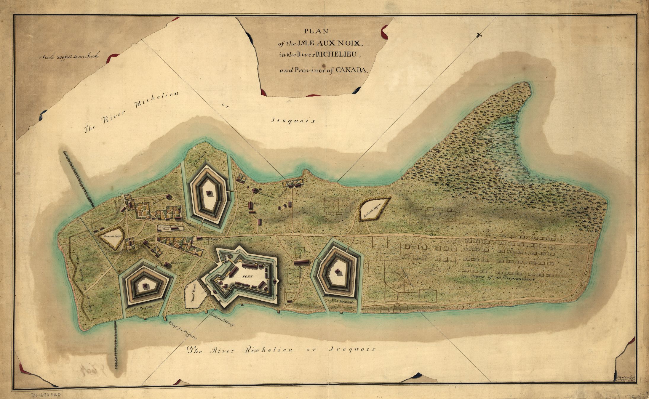
English: This is a map of fortifications on the Ile aux Noix, circa 1760. Caption reads:
Plan of the Isle aux Noix, in the River Richelieu, and Province of Canada. [Signed:] T. Walker, Capt., 60th regt. delt. |
||
| Date | circa 1760 | ||
| Source |
|
||
| Author | Thomas Walker |

Licensing
|
This is a faithful photographic reproduction of a two-dimensional, public domain work of art. The work of art itself is in the public domain for the following reason:
The official position taken by the Wikimedia Foundation is that "faithful reproductions of two-dimensional public domain works of art are public domain". This photographic reproduction is therefore also considered to be in the public domain in the United States. In other jurisdictions, re-use of this content may be restricted; see Reuse of PD-Art photographs for details. ((PD-Art)) template without license parameter: please specify why the underlying work is public domain in both the source country and the United States
(Usage: ((PD-Art|1=|deathyear=''year of author's death''|country=''source country'')), where parameter 1= can be PD-old-auto, PD-old-auto-expired, PD-old-auto-1996, PD-old-100 or similar. See Commons:Multi-license copyright tags for more information.) | ||||
File history
Click on a date/time to view the file as it appeared at that time.
| Date/Time | Thumbnail | Dimensions | User | Comment | |
|---|---|---|---|---|---|
| current | 01:58, 15 April 2009 | | 2,190 × 1,347 (534 KB) | Magicpiano | ((Information |Description=((en|1=This is a map of fortifications on the w:Ile aux Noix, circa 1760. Caption reads: Plan of the Isle aux Noix, in the River Richelieu, and Province of Canada. [Signed:] T. Walker, Capt., 60th regt. delt. )) |Source=(( |
File usage
The following pages on the English Wikipedia use this file (pages on other projects are not listed):
Global file usage
The following other wikis use this file:
- Usage on ceb.wikipedia.org
- Usage on es.wikipedia.org
- Usage on fr.wikipedia.org
- Usage on it.wikipedia.org
- Usage on ja.wikipedia.org
- Usage on www.wikidata.org
Metadata
Text is available under the CC BY-SA 4.0 license; additional terms may apply.
Images, videos and audio are available under their respective licenses.
Cover photo is available under {{::mainImage.info.license.name || 'Unknown'}} license.
Cover photo is available under {{::mainImage.info.license.name || 'Unknown'}} license.
Credit:
(see original file).
