File:Former Stravithie airfield watch office - geograph.org.uk - 115002.jpg
No higher resolution available.
Former_Stravithie_airfield_watch_office_-_geograph.org.uk_-_115002.jpg (640 × 480 pixels, file size: 162 KB, MIME type: image/jpeg)
| This is a file from the Wikimedia Commons. Information from its description page there is shown below. Commons is a freely licensed media file repository. You can help. |
Summary
| Description |
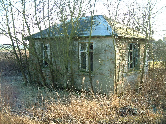
English: Former Stravithie airfield watch office. This dilapidated building (and a tractor shed next to it) are all that is left to mark where, from 1941 till 1945, a RAF satellite landing ground was in use. Hurricanes, Wellingtons and even four-engine bombers like Halifaxes once landed and took off from the relatively small field behind and to the left of this building. |
| Date | |
| Source | From geograph.org.uk |
| Author | James Allan |
| Attribution (required by the license) | James Allan / Former Stravithie airfield watch office / |
| Object location | | View this and other nearby images on: OpenStreetMap |
|---|
Licensing

|
This image was taken from the Geograph project collection. See this photograph's page on the Geograph website for the photographer's contact details. The copyright on this image is owned by James Allan and is licensed for reuse under the Creative Commons Attribution-ShareAlike 2.0 license.
|
This file is licensed under the Creative Commons Attribution-Share Alike 2.0 Generic license.
Attribution: James Allan
- You are free:
- to share – to copy, distribute and transmit the work
- to remix – to adapt the work
- Under the following conditions:
- attribution – You must give appropriate credit, provide a link to the license, and indicate if changes were made. You may do so in any reasonable manner, but not in any way that suggests the licensor endorses you or your use.
- share alike – If you remix, transform, or build upon the material, you must distribute your contributions under the same or compatible license as the original.
File history
Click on a date/time to view the file as it appeared at that time.
| Date/Time | Thumbnail | Dimensions | User | Comment | |
|---|---|---|---|---|---|
| current | 09:49, 31 January 2010 | | 640 × 480 (162 KB) | GeographBot | == ((int:filedesc)) == ((Information |description=((en|1=Former Stravithie airfield watch office. This dilapidated building (and a tractor shed next to it) are all that is left to mark where, from 1941 till 1945, a RAF satellite landing ground was in use. |
File usage
The following pages on the English Wikipedia use this file (pages on other projects are not listed):
Metadata
Text is available under the CC BY-SA 4.0 license; additional terms may apply.
Images, videos and audio are available under their respective licenses.
Cover photo is available under {{::mainImage.info.license.name || 'Unknown'}} license.
Cover photo is available under {{::mainImage.info.license.name || 'Unknown'}} license.
Credit:
(see original file).
